Backroads Around Las Vegas, Red Rock Canyon NCA
 Highway 160 passing end of highway divider (view SW) |
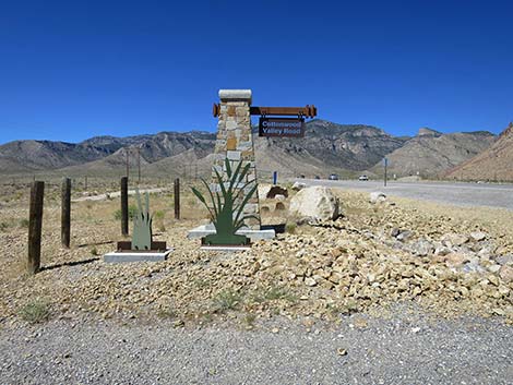
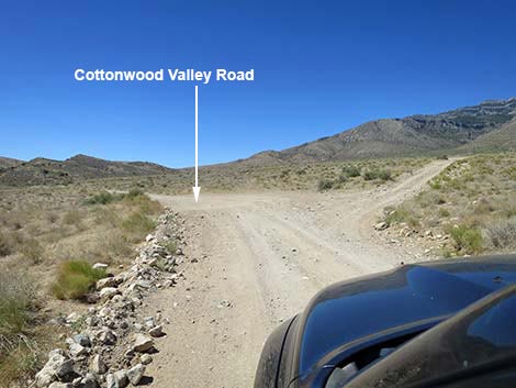
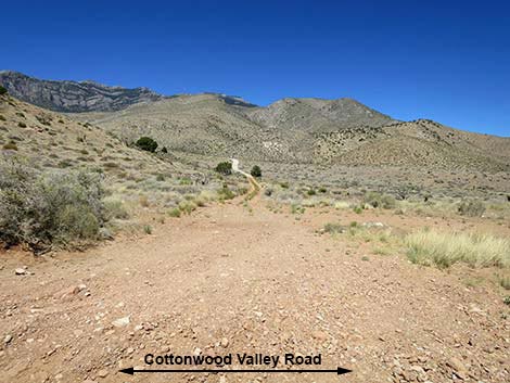
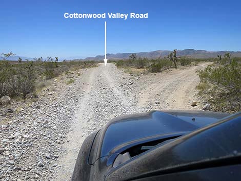
Overview Cottonwood Valley Road, also called Goodsprings Road, runs north-south between Highway 160 and Highway 161 (Sandy Valley Road) near the town of Goodsprings. The northern 10.8 miles of Cottonwood Valley Road is a rarely maintained dirt road, but the southern 3.2 miles run on pavement. This road provides access to hiking, biking, equestrian, and camping opportunities between Mt. Potosi and the Birdspring Range. North of Cottonwood Pass, the road can be washed out and quite rough, and the climb onto Cottonwood Pass usually requires a 4WD vehicle, but currently (2025), the road is in fairly good shape. In 2005, the Goodsprings Fire burned 33,600 acres in the Cottonwood and Goodsprings valley areas. In 2020, the Cottonwood Fire reburned 2,800 acres, mostly south of Cottonwood Pass. Fires are changing the Mojave Desert from a shrubland to a grassland as drought, invasive species, and climate change march on. Link to map. |
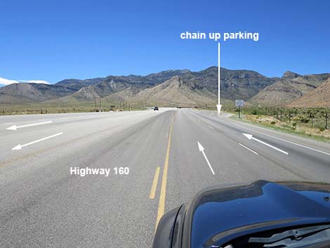
 Highway 160 at Chain Up parking area (view SW) |
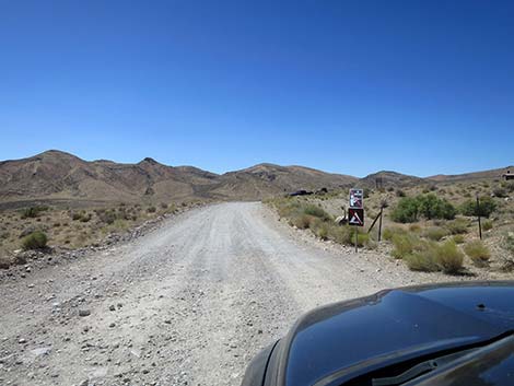
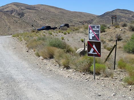
Other than the standard warnings about driving in the desert, ...this road is getting to be a pretty rough ride, at least on the north end. Cell phones work in some areas. This is a major mountain biking area, so keep an eye out for inattentive bikers careening across the road (bike trails cross the road many times) or just careening down the road. When turning from Highway 160 westbound onto Cottonwood Valley Road, be extra careful turning left in front of oncoming traffic. The speed limit is only 65 mph, but expect vehicles to be traveling downhill at 70-80 mph. Be patient and leave extra room before turning. While out, please respect the land and the other people out there, and try to Leave No Trace of your passage. Also, be sure to bring what you need of the 10 Essentials. |
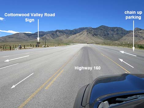
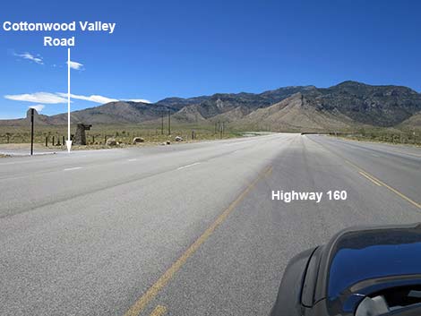
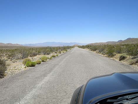
 Highway 160, approaching Cottonwood Valley Road (view SW) |
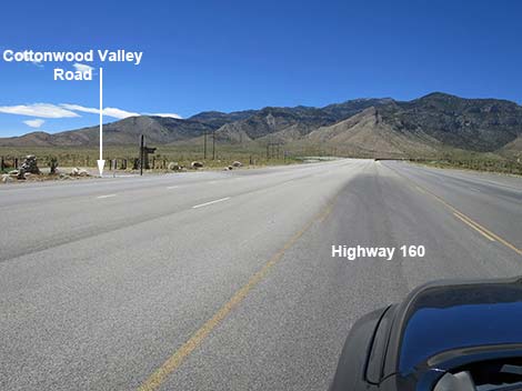
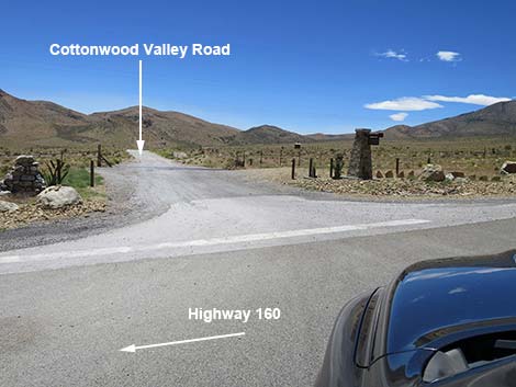
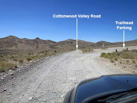
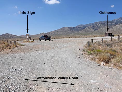
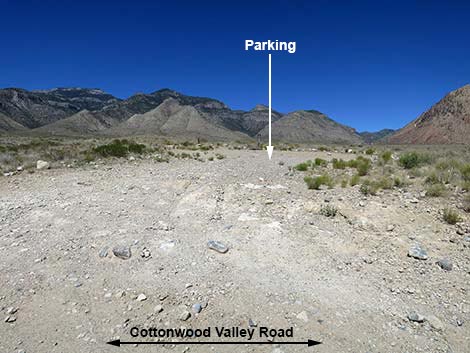
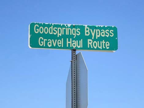
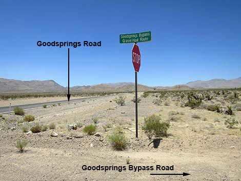
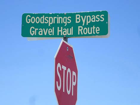
Getting to the Roadhead To access the north end of Cottonwood Valley Road from Las Vegas, drive west on Highway 160 (Pahrump Highway). Past Late Night Trailhead, the next gap in the highway divider provides left-turn access onto Cottonwood Valley Road and the Cottonwood Valley Trailhead. To access the south end of Cottonwood Valley Road from Las Vegas, drive south on Interstate-15 to Jean. Exit the interstate and turn right onto Highway 161 (watch for signs to Goodsprings, Sandy Valley, and the Pioneer Saloon). Drive northwest for about 5.5 miles to Goodsprings Bypass Road -- Gravel Haul Road. Watch for a street sign and a stop sign on one pole. Turn right onto Goodsprings Bypass Road and follow the pavement north around the east side of Goodsprings town. The road bends hard left to run westward around the north side of town and arrives at a stop sign. Turn right following the pavement and drive north about 1.3 miles to a dirt road that forks right (Table 1, Site 1368). Turn right onto the dirt road; this is Cottonwood Valley Road. |
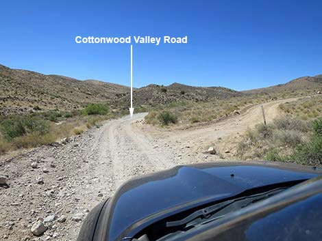
 Highway 160, at Cottonwood Valley Road (view SW) |
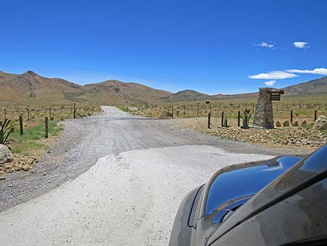
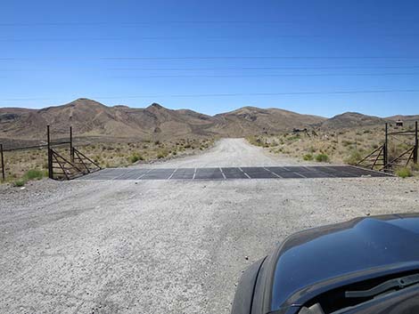
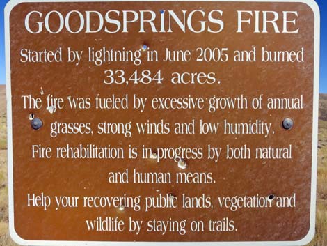
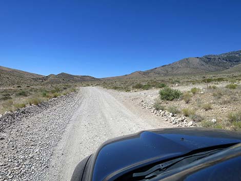
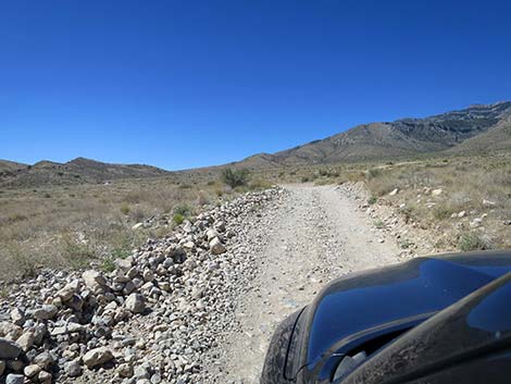
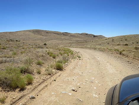
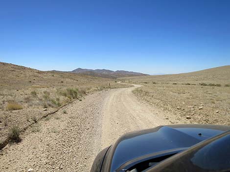
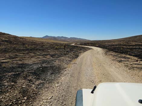
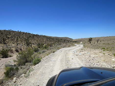
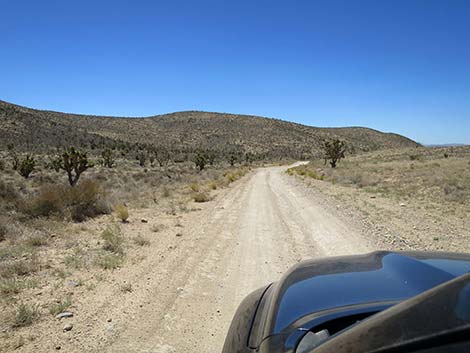
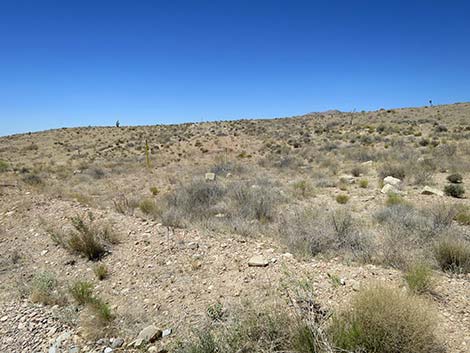
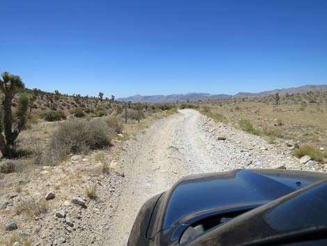
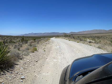
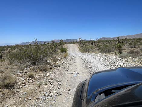
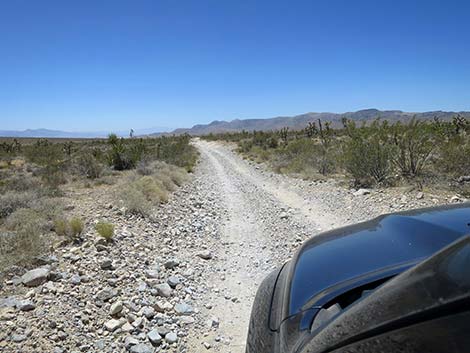
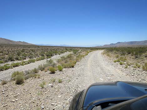
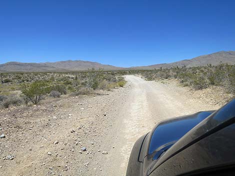
The Road From the pavement at Highway 160, Cottonwood Valley Road crosses a cattle guard, runs out onto the dirt, and heads south. Initially, the road is relatively well maintained and two lanes wide. At about 200 yards out, Cottonwood Valley Road passes Cottonwood Valley Trailhead, a popular trailhead for mountain bikers. Continuing south, the road passes a sign on the left with information about the 33,500-acre Goodsprings Fire. In 2005, this fire burned everything visible east of the road almost to Cottonwood Pass, and then both sides of the road for another 3 miles. After that, the fire burned the west side of the road for 2 more miles. Wildfires in the desert are not the same as fires in the forest. In the forest, fires are generally beneficial and rejuvenate the forest ecosystem. This is not the case in the desert. Here, fires are very detrimental because desert shrubs did not evolve under a fire regime and therefore mostly die when burned. |
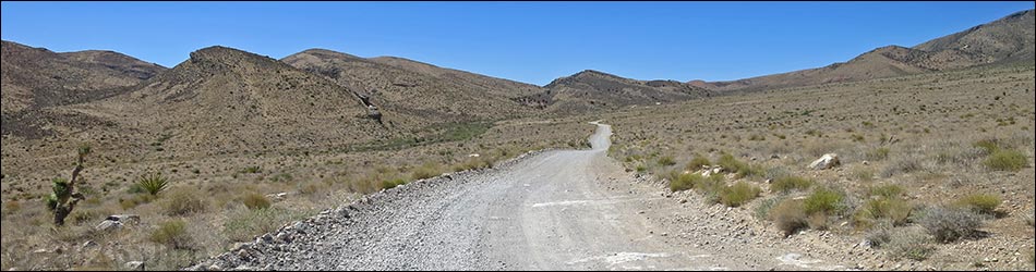
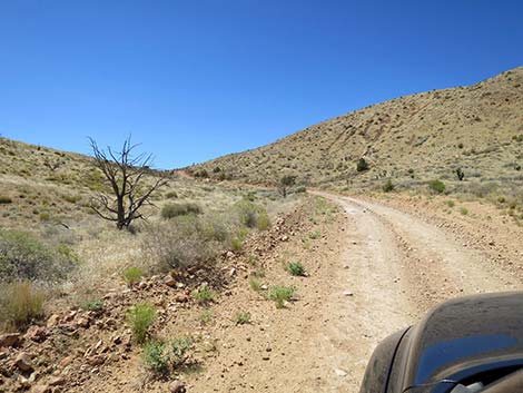
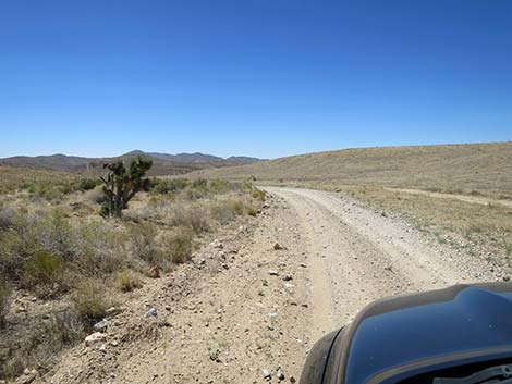
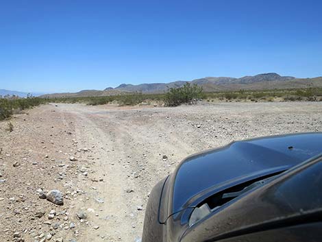
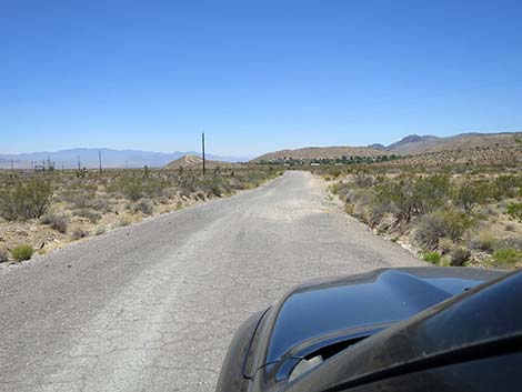
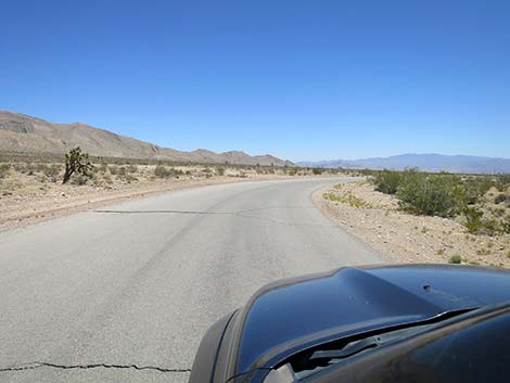
 Cottonwood Valley Road (view S from Highway 160) |
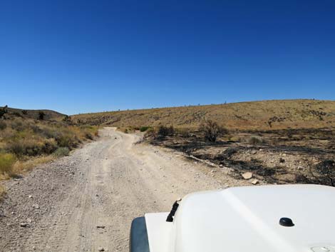
In the desert, when shrubs burn, they usually are replaced by non-native, invasive grass species, which make the next fire more likely to spread because the grasses are so flammable. After two or more fires, the entire desert shrub ecosystem can be converted to an annual grassland ecosystem of non-native grasses. Unfortunately, fires start frequently along Cottonwood Valley Road, making this an interesting study in how the native desert shrubland is converting to a non-native grassland. In central and northern Nevada, Cheatgrass usually moves in, but in southern Nevada, we have Cheatgrass' desert cousin: Red Brome Grass. In 2020, the Cottonwood Fire burned about 2,800 acres south of Cottonwood Pass. A few Utah Juniper and Eastern Joshua Trees survived both fires, but generally, the habitat there has fully converted to an annual grassland. It will be interesting to see over the years, if our desert shrubland manages to come back, but probably it is gone for our lifetime because drought and climate change make it too dry for shrub species to germinate and for their seedlings to grow. |
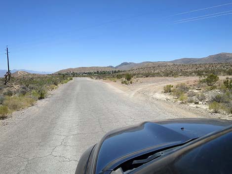
 Turning onto Cottonwood Valley Road (view S) |
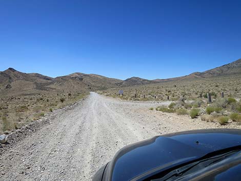
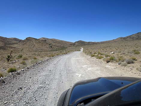
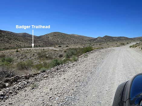
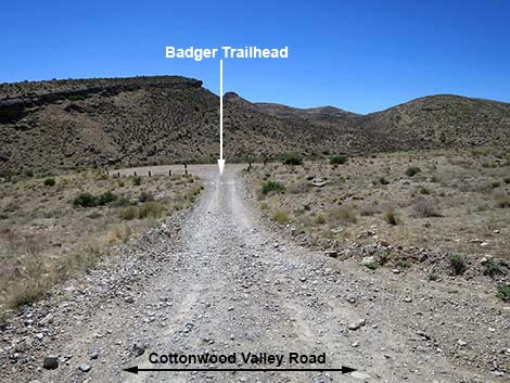
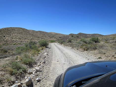
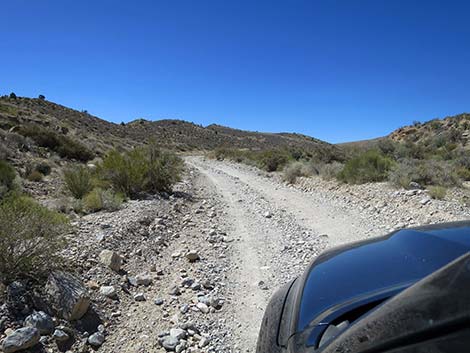
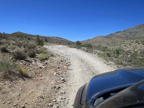
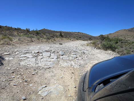
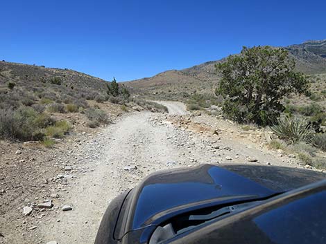
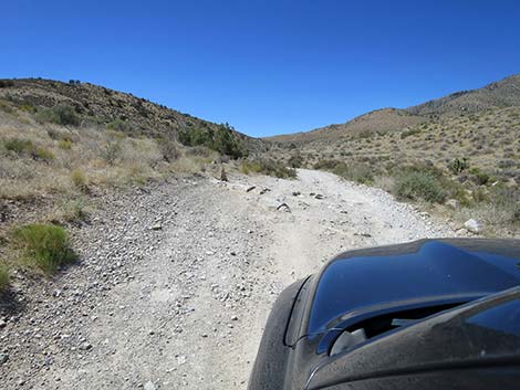
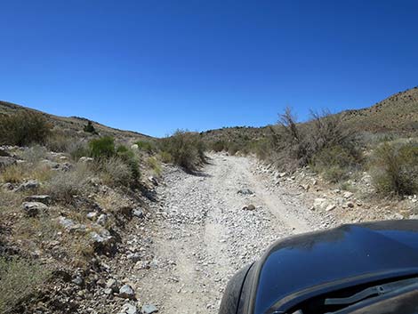
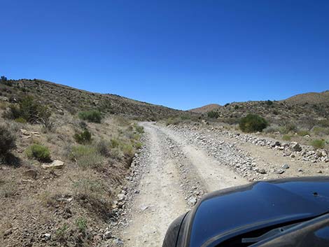
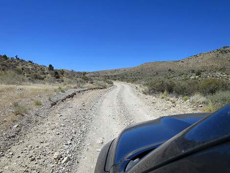
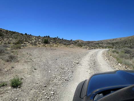
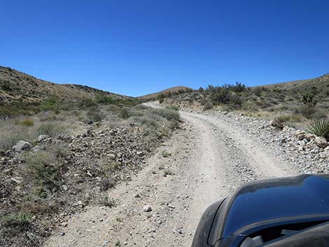
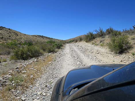
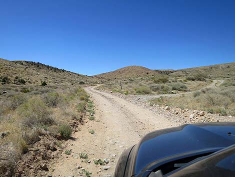
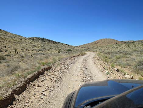
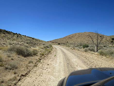
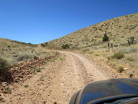
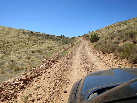
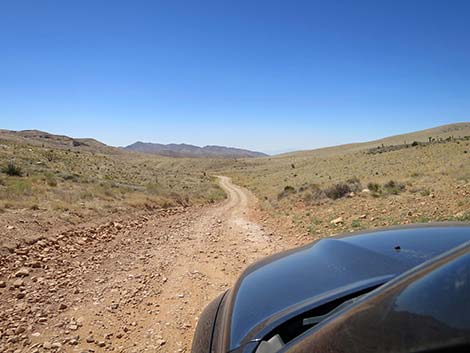
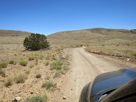
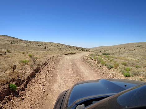
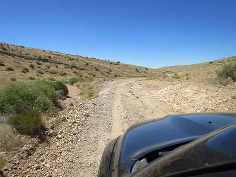
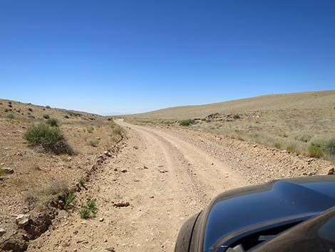
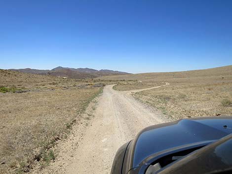
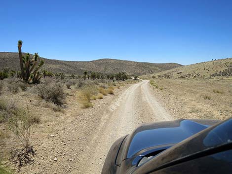
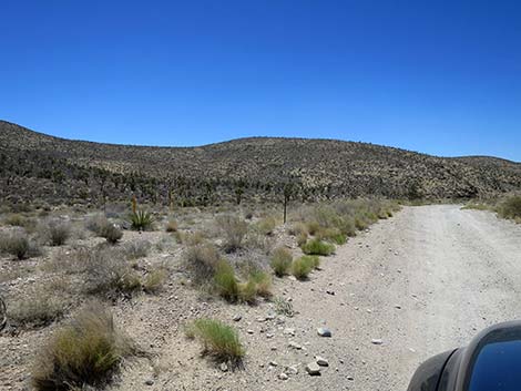
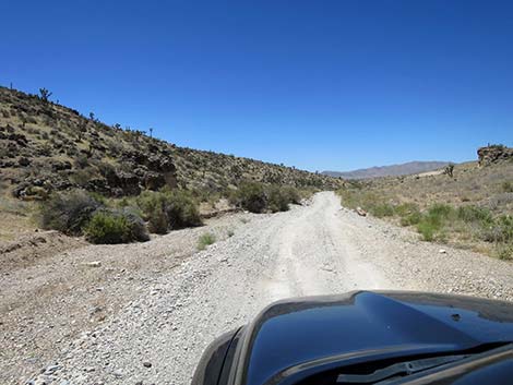
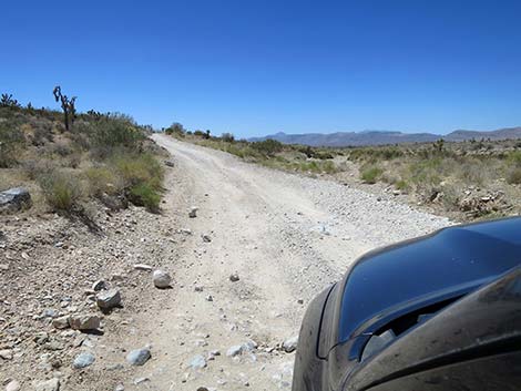
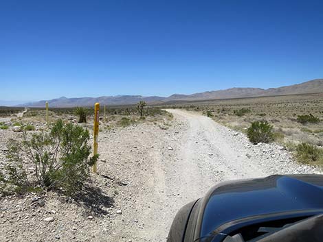
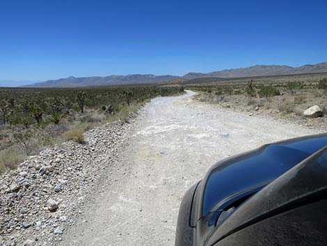
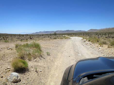
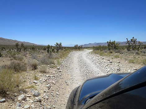
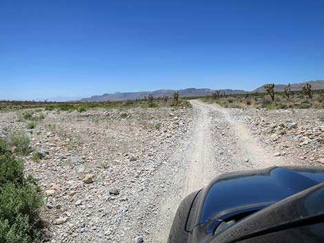
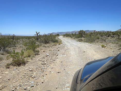
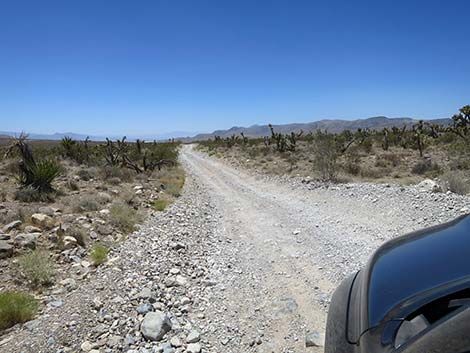
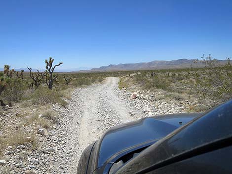
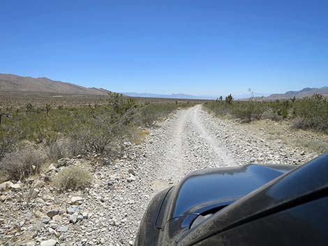
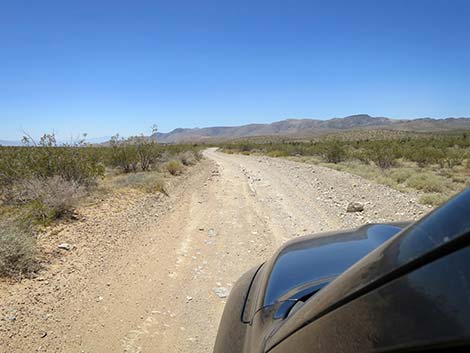
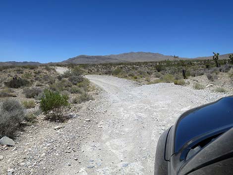
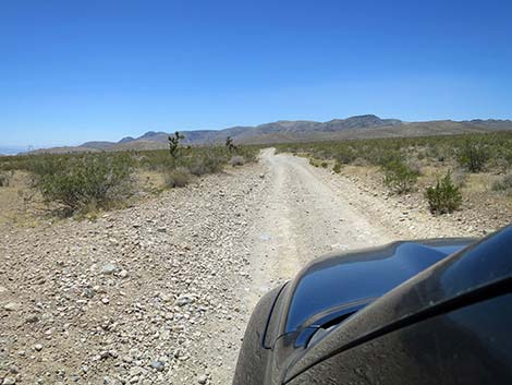
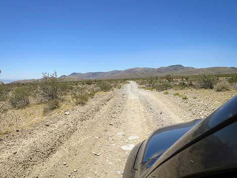
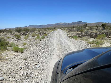
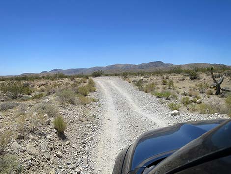
Continuing, at about 0.7 miles out, Cottonwood Valley Road passes Badger Pass Trailhead Road (Site 1542) on the left. This is another popular trailhead used by mountain bikers and hikers. The parking corral at the trailhead can be seen from the main road. By this time, it is apparent that Cottonwood Valley Road is running up a valley, with Mt. Potosi in Spring Mountains on the west and the Birdspring Range on the east. This is the case all the way south to Goodsprings. Just past Badger Pass Trailhead Road, Cottonwood Valley Road narrows and becomes more washed out and rocky. The road passes several side roads, but Cottonwood Valley Road always is the obvious, straight ahead, main-road. At about 1.5 miles out, Cottonwood Valley Road drops into the wash. It more-or-less remains in the wash where some parts can be quite rocky. At about 3.0 miles out, the road climbs out of the wash when it starts to climb over Cottonwood Pass. |
 Cottonwood Valley Road sign (view W) |
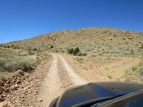
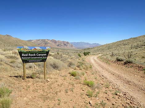
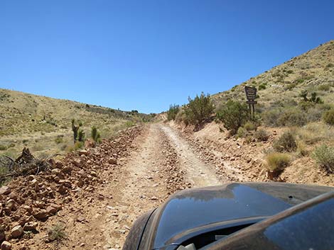
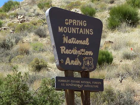
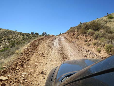
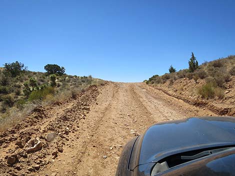
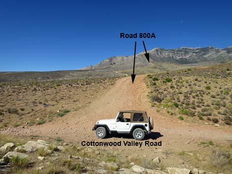
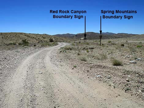
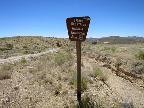
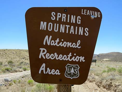
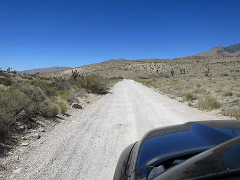
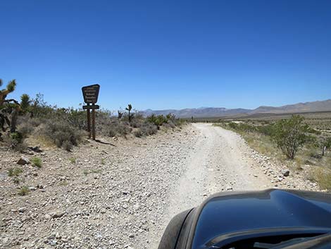
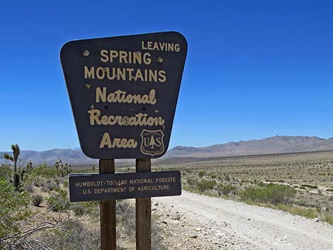
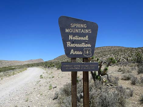
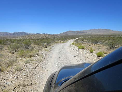
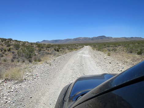
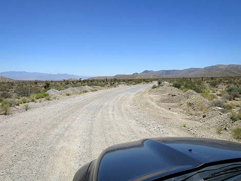
Climbing the north side of Cottonwood Pass, Cottonwood Valley Road is steep and can be deeply rutted and rocky. I've taken to driving this section in 4WD just to make it easier to control my truck, but it probably isn't absolutely necessary. Near the top of the pass, signs announce that the road is leaving Red Rock Canyon National Conservation Area and entering Spring Mountains National Recreation Area. Soon thereafter, the road climbs atop Cottonwood Pass (Site 0850; 3.2 miles out). Atop the pass, an old road to the left (east), now a trail, runs up about 100 yards to an overlook. The road to the right (west; Toiyabe Forest Road [FR] 800A) runs about 200 yards to a red sandstone outcrop. Beyond that point, FR-800A becomes extremely rough and is better suited for ATVs than trucks or jeeps. Beyond Cottonwood Pass (Site 0850), Cottonwood Valley Road generally usually is in better condition as it runs gently down Goodsprings Valley. The road can be washed out, but drivers generally pound the road into something drivable between rare maintenance events. |
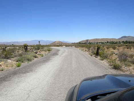
 Start of Cottonwood Valley Road (view S) |
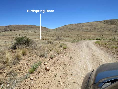
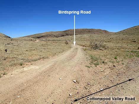
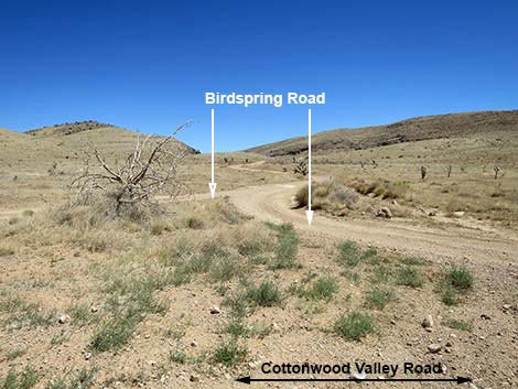
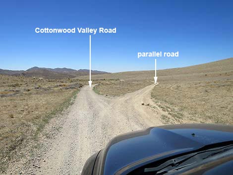
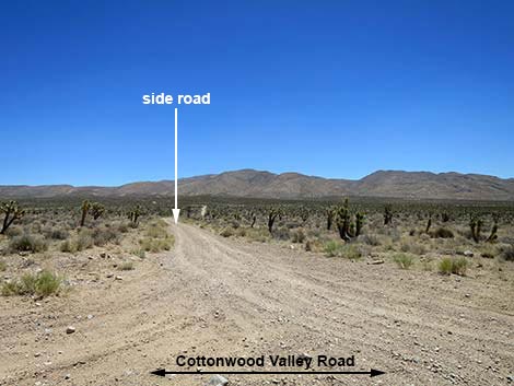
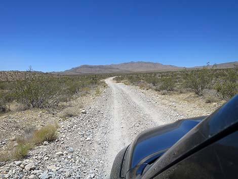
Continuing over Cottonwood Pass on the comparatively smooth and gentle road, Cottonwood Valley Road bends east and soon passes a Utah Juniper that has now survived two fires. Just past the juniper, Cottonwood Valley Road arrives at Birdspring Road (Site 0851; 3.5 miles out), the first side of a triangular intersection for Birdspring Road, which runs 0.7 miles to an overlook with grand views of Las Vegas and the trailhead for Birdspring Peak. Continuing south, Cottonwood Valley Road runs on easy terrain curving gently left and right following the bottom of the Cottonwood Valley. At about 4.27 miles out, the road forks. Cottonwood Valley Road stays left, while the right fork forms a lesser road that runs parallel to the main road for about 0.40 miles. The two forks become separated by a deep erosion ditch that once cut off access to a side road on the right (Site 0488; 4.7 miles out). This is Ninetynine Mine Road (FR-800B), which runs out to the Dawn Mine, Ninetynine Mine, and the trailhead for the tough climb to the Carol Lombard Crash Site. FR-800B is badly washed out, quite rocky, and largely abandoned, but still passable in 4WD. It is now easier to continue south on the main road and use other roads to get up into the Ninetynine Mine area. |
 Cottonwood Valley Road crosses a cattle guard (view S) |
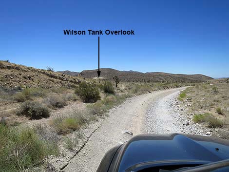
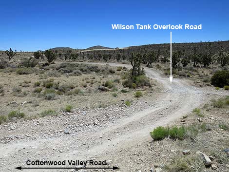
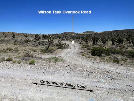
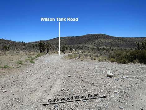
Continuing south past the parallel road, the main road forks again to form another parallel road. This time, Cottonwood Valley Road stays right, and the parallel road runs down a wash for about 0.2 miles before rejoining the main road. Before the parallel road rejoins the main road, drivers will pass boundary signs for Red Rock Canyon and the Spring Mountains once again. At this point, drivers are re-entering Red Rocks, but for the next 1.8 miles, the road basically follows the boundary between them. At about 4.98 miles out, Cottonwood Valley Road arrives an intersection (Site 1543) with a side road to the left (another triangle intersection). Here, Wilson Tank Overlook Road branches left and climbs about 0.2 miles to a large parking area that can be seen from the main road. Wilson Tank Overlook provides grand views over the other side of the mountain into the northern Las Vegas Valley. The taller downtown buildings are visible. |
 Cottonwood Valley Road approaching symbol signs (view S) |
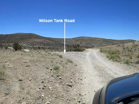
Continuing south, at about 5.18 miles out, Cottonwood Valley Road passes out of the 2020 Cottonwood Fire zone, but remains within the 2005 Goodsprings Fire zone, so for the next few miles, the desert here has only burned once. At about 5.31 miles out, Cottonwood Valley Road reaches an intersection (Site 1543) with Wilson Tank Road, to the left. This road runs east as it climbs over the mountain, then drops through a canyon, passing Wilson Tank (a guzzler), and eventually running northeast to connect with Highway 160. Farther out, reportedly, it is hard to tell which roads most efficiently return to the highway. Past Wilson Tank Road, fire fighters kept the fire from jumping the road, so the left (east) side of the road is unburned, making a nice contrast with the right (west) side of the road, which burned in 2005. Some shrubs are growing back, but the contrast remains striking. |
 Signs: No Shooting and No Camping (view S) |
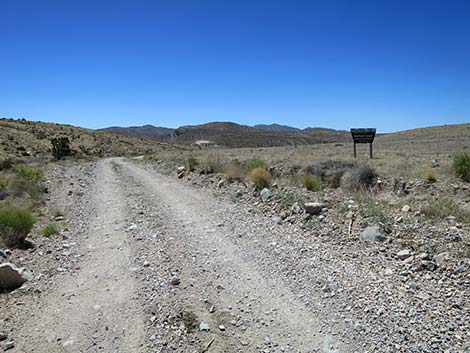
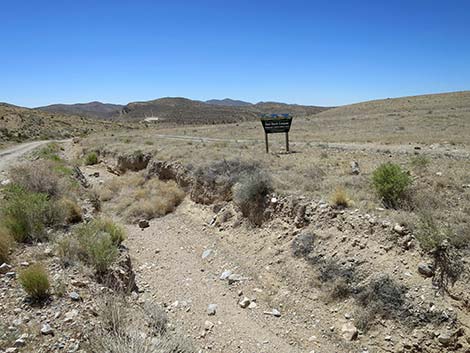
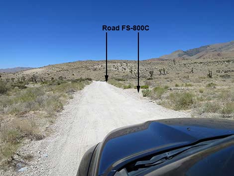
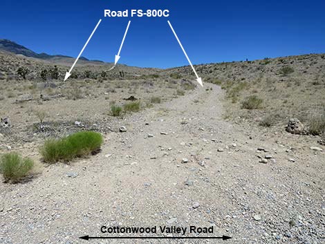
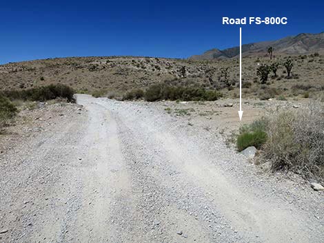
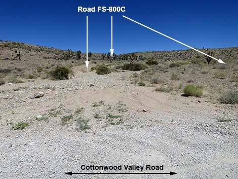
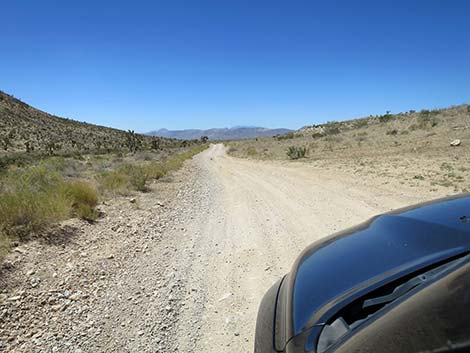
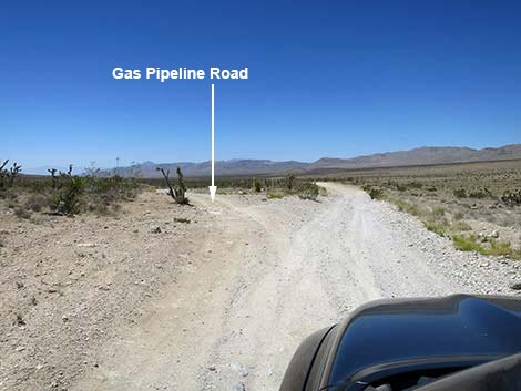
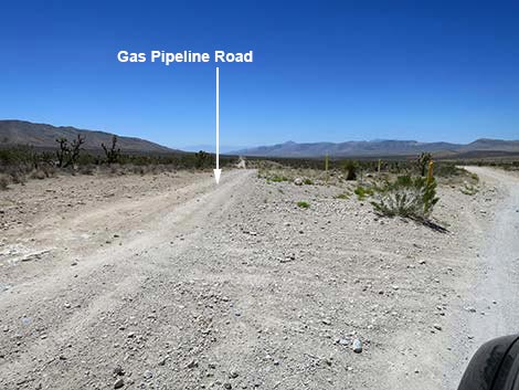
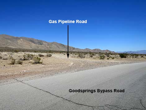
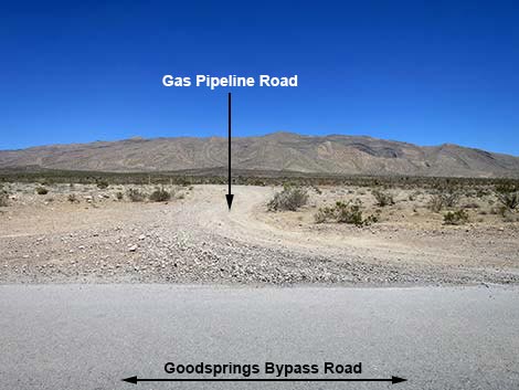
Continuing south, at about 5.46 miles out, Cottonwood Valley Road crosses a gas pipeline, a wide gash in the vegetation that can be seen running across the desert for miles. It is nice to see plants growing back here. Shortly, the road runs down into a narrow canyon and bends to the right heading more westerly. In the canyon bottom, shrubs grow densely along the wash. At about 5.6 miles out, Cottonwood Valley Road reaches another side road to the right; this is FR-800C, which runs about 3.2 miles northwest to Ninetynine Mine and the trailheads for the Carol Lombard Crash Site. This is another triangular intersection, and the other fork is about 40 yards farther down the canyon. At about 5.90 miles out, Cottonwood Valley Road exits the mountains and begins running down into the broad and flat Goodsprings Valley. At about 6.47 miles out, Cottonwood Valley Road crosses the gas pipeline again, and here a pipeline road forks left to follow the pipeline. Just a few yards farther, the road exits Red Rocks and Spring Mountains for a final time. |
 Approaching Cottonwood Valley Trailhead (view S) |
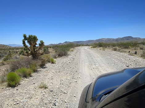
At about 7.44 miles out, the road passes a minor side road to the right that held as part of the southern fireline during the 2005 Goodsprings Fire. The road finally crosses out of the burn zone, and for the rest of the drive, the desert vegetation remains unburned with lots of Eastern Joshua Trees all around. At about 7.69 miles out, Cottonwood Valley Road passes a well used side road that branches to the left. This road heads east across the valley and climbs into the mountains and the southern most section of Red Rock Canyon NCA. At about 9.24 miles out, Cottonwood Valley Road passes a minor fork to the right. This road runs southwest across the valley and connects with the pavement, but it looks like a rough road.
|
 Cottonwood Valley Road at entrance to the trailhead (view SW) |
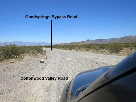
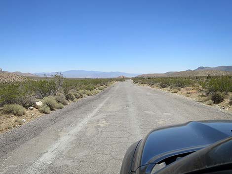
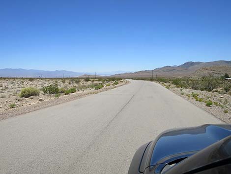
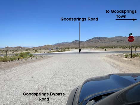
At about 9.97 miles out, Cottonwood Valley Road bends hard to the right to run west and crosses several washes. At about 10.25 miles out, it begins bending back to the south and finally runs out to the pavement (about 10.68 miles out; Site 1368). It seems that Cottonwood Valley Road ends here, but some maps show it continuing to Goodsprings Town. Currently, Google Maps show the paved road as Goodsprings Bypass Road. Staying left onto the pavement, Goodsprings Bypass Road heads south to Goodsprings, but the road into town is barricaded, and drivers are forced to turn left, still staying on Goodsprings Bypass Road. The pavement eventually bends right and runs south to end at a stop sign on Goodsprings Road. For drivers in a hurry, turn left and drive 5.5 miles southeast to Interstate 15. For others, consider turning right driving into the historic town. Stop at the Pioneer Saloon for a cold beverage, then let the designated driver drive back down to Interstate 15 and home. |
 Approaching exit from Cottonwood Valley Trailhead (view S) |
 Two information signs (view S) |
 Cottonwood Valley Rd approaching information sign on right (view S) |
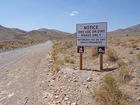 Sign: Motor vehicles can not use bike trails |
 Sign: Motor vehicles can not use bike trails |
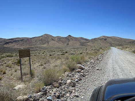 Cottonwood Valley Road approaching info sign on the left (view S) |
 Goodsprings Fire information sign (view SE) |
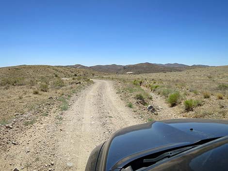
 Continuing on Cottonwood Valley Road (view S) |
 Continuing on Cottonwood Valley Road (view S) |
 Cottonwood Valley Road approaching a parking area (view S) |
 Parking area (view W from Cottonwood Valley Road) |
 Continuing on Cottonwood Valley Road (view S) |
 Cottonwood Valley Road at Badger Trailhead Road (view SE) |
 Badger Trailhead Road (view E from Cottonwood Valley Rd) |
 Continuing on Cottonwood Valley Road (view S) |
 Cottonwood Valley Road at a side road (view SE) |
 Continuing on Cottonwood Valley Road (view S) |
 Cottonwood Valley Road at a side road (view SE) |
 Cottonwood Valley Road begins climbing into a canyon (view S) |
 Cottonwood Valley Road approaching a rocky spot (view S) |
 Cottonwood Valley Road at a rocky spot (view S) |
 Cottonwood Valley Rd approaching another rocky spot (view S) |
 Cottonwood Valley Rd approaching another rocky spot (view S) |
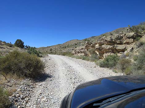 Cottonwood Valley Rd passing nice layered rock face (view S) |
 Cottonwood Valley Rd at a campsite (view S) |
 Cottonwood Valley Road at a side road (view SE) |
 Cottonwood Valley Rd climbing towards the mountains (view S) |
 Cottonwood Valley Rd (view S) |
 Cottonwood Valley Rd (view S) |
 Cottonwood Valley Rd (view S) |
 Cottonwood Valley Rd at a campsite (view S) |
 Cottonwood Valley Rd (view S) |
 Cottonwood Valley Rd (view S) |
 Cottonwood Valley Rd approaching a side road (view S) |
 Cottonwood Valley Rd (view S) |
 Cottonwood Valley Rd (view S) |
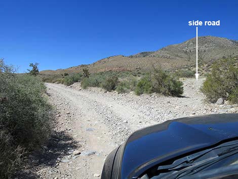
 Cottonwood Valley Road at a side road (view SE) |
 Side road (view NW from Cottonwood Valley Road) |
 Cottonwood Valley Rd approaching Cottonwood Pass (view S) |
 Cottonwood Valley Rd approaching boundary signs (view S) |
 Looking back: Red Rock Canyon NCA boundary sign (view N) |
 Cottonwood Valley Rd approaching another boundary signs (view S) |
 Sign: Spring Mountains NRA boundary (view SW) |
 Cottonwood Valley Rd approaching Cottonwood Pass (view S) |
 Steepest part of Cottonwood Valley Rd (view S) |
 Cottonwood Valley Rd approaching Cottonwood Pass (view S) |
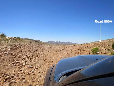 Arriving at Cottonwood Pass (view S) Road 800A (ATV trail) at right |
 Road 800A (view W from Cottonwood Pass) |
 Road 800A (view W from Cottonwood Pass) |
 Cottonwood Valley Rd starting over Cottonwood Pass (view S) |
 Cottonwood Valley Rd continuing past Cottonwood Pass (view S) |
 A Utah Juniper survived two fires (view E) |
 Cottonwood Valley Road at Birdspring Road (view E) |
 Birdspring Road (view NE from Cottonwood Valley Road) |
 Birdspring Road (view N from Cottonwood Valley Road) |
 Cottonwood Valley Road continuing past Birdspring Road (view SE) |
 Cottonwood Valley Rd (view S) |
 Cottonwood Valley Rd (view S) |
 Cottonwood Valley Rd in the twice-burned zone; 2025 (view S) |
 Cottonwood Valley Road; August 2020 (view S) |
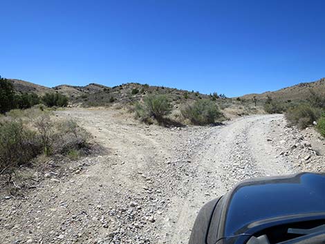
 Cottonwood Valley Rd approaching a fork (view S) |
 Cottonwood Valley Rd at a fork (4.27 miles out; view S) |
 Cottonwood Valley Rd and parallel road (view S) |
 Cottonwood Valley Rd; note start of erosion ditch (view S) |
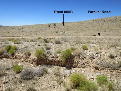 Abandoned Road 800B (view W across erosion ditch) |
 Cottonwood Valley Rd approaching jurisdictional boundary (view SE) |
 Sign: leaving Spring Mountain NRA southbound (view S) |
 Sign: leaving Spring Mountain NRA southbound (view S) |
 Cottonwood Valley Rd nearing Red Rock boundary sign in 2025 |
 Erosion ditch and Red Rock boundary sign in 2025 |
 Red Rock boundary sign in 2020 (view S) |
 Red Rock boundary sign in 2025 (view S) |
 Parallel road returns to Cottonwood Valley Rd (view S) |
 Cottonwood Valley Rd (view S towards Wilson Tank Overlook) |
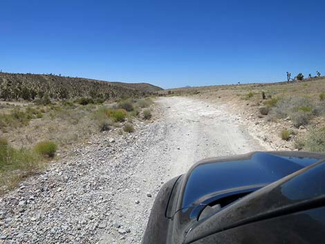 Cottonwood Valley Rd (view S) |
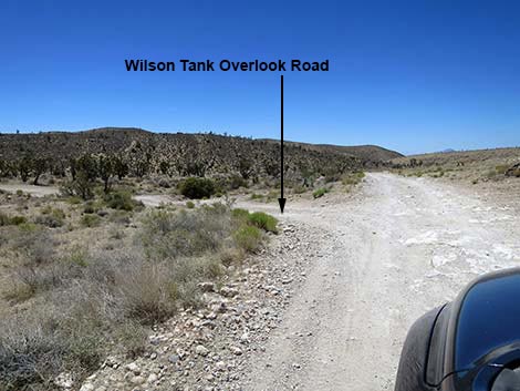 Cottonwood Valley Road at Wilson Tank Overlook Road (5 miles out) |
 Wilson Tank Overlook Road (view E from Cottonwood Valley Rd) |
 Wilson Tank Overlook Road (view NE from Cottonwood Valley Rd) |
 C-wood Valley Rd continues past Wilson Tank Overlook Rd (view E) |
 Cottonwood Valley Rd continues (view S) |
 Cottonwood Valley Road approaching Wilson Tank Road (view S) |
 Wilson Tank Road (view E from Cottonwood Valley Road) |
 Cottonwood Valley Road (view S) |
 Cottonwood Valley Road (view S towards edge of 2020 fire) |
 Cottonwood Valley Road approaching buried gas pipeline (view S) |
 Buried gas pipeline (view NE from Cottonwood Valley Road) |
 Buried gas pipeline (view SW from Cottonwood Valley Road) |
 Cottonwood Valley Road enters a bit of a canyon (view SW) |
 Cottonwood Valley Road at Razer-washboards (view SW) |
 Cottonwood Valley Road approaching Road FS-800C (view SW) |
 First branch of Road FS-800C (view N from C-wood Valley Road) |
 Cottonwood Valley Road approaching Road FS-800C (view SW) |
 Second branch of Road FS-800C (view N from C-wood Valley Road) |
 Cottonwood Valley Road continues past Road FS-800C (view SW) |
 Cottonwood Valley Road approaching sign posts (view SW) |
 Cottonwood Valley Road climbing out of a wash (view SW) |
 Cottonwood Valley Road approaching another boundary sign (view SW) |
 Boundary sign: exiting Spring Mountains NRA (view SW) |
 Looking back: entering Spring Mountains NRA (view N) |
 Cottonwood Valley Road approaching a fork (view SW) |
 Gas Pipeline Road stays left a fork (view S) |
 Cottonwood Valley Road continues past pipeline road (view SW) |
 Cottonwood Valley Road (view SW) |
 Cottonwood Valley Rd runs across caliche (i.e., rough road; view SW) |
 Cottonwood Valley Road crossing a desert wash (view SW) |
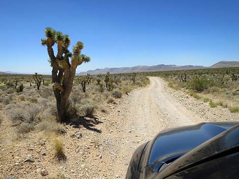
 Cottonwood Valley Road runs past Eastern Joshua Trees (view S) |
 Cottonwood Valley Road at a side road right (view SW) |
 Cottonwood Valley Road at a side road left (view SW) |
 Well used side road (view E from Cottonwood Valley Road) |
 Cottonwood Valley Road continuing past side road (view S) |
 Cottonwood Valley Road runs past Eastern Joshua Trees (view S) |
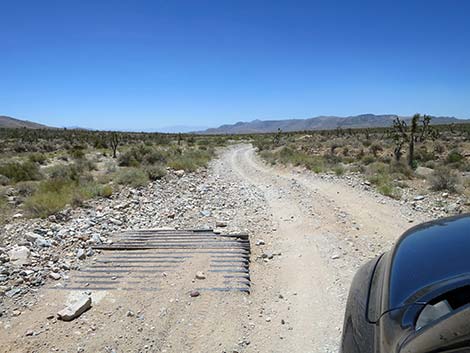 Cottonwood Valley Road at an historical cattle guard (view S) |
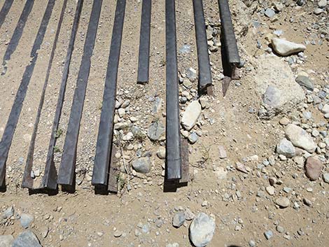 historical cattle guard made from old railroad tracks (view down) |
 Cottonwood Valley Road crossing a bigger desert wash (view SW) |
 Cottonwood Valley Road continues past the wash (view SW) |
 Cottonwood Valley Road (view SW) |
 Cottonwood Valley Road (view SW) |
 Cottonwood Valley Road (view SW) |
 Cottonwood Valley Road (view SW) |
 Cottonwood Valley Road (view SW) |
 C-wood Valley Rd forks; right goes to pavement too(view SW) |
 Grand scenery all around (view E from Cottonwood Valley Rd) |
 Cottonwood Valley Road (view S) |
 Cottonwood Valley Road runs on bluff above wash (view S) |
 Cottonwood Valley Road gets pretty comfortable (view S) |
 Cottonwood Valley Rd approaching a sweeping curve right (view S) |
 Cottonwood Valley Rd approaching a sweeping curve right (view W) |
 Cottonwood Valley Rd heads towards Mt. Potosi (view W) |
 Cottonwood Valley Rd approaching a sweeping curve left (view W) |
 Cottonwood Valley Rd enters a sweeping curve left (view W) |
 Cottonwood Valley Rd curving left (view SW) |
 Cottonwood Valley Rd now runs straight for a while (view SW) |
 Cottonwood Valley Rd at another Joshua Tree (view SW) |
 Cottonwood Valley Road (view SW) |
 Cottonwood Valley Road (view SW) |
 Cottonwood Valley Road approaching a wash (view SW) |
 Cottonwood Valley Road crossing a wash (view SW) |
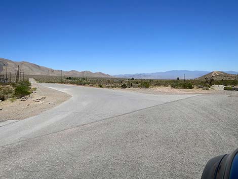
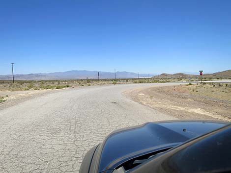
 Cottonwood Valley Road approaching a paved road (view SW) |
 Cottonwood Valley Road ends at Goodsprings Bypass Road (view SW) |
 At washes, Goodsprings Bypass Rd can be covered in gravel (view S) |
 Goodsprings Bypass Rd (view S) |
 Goodsprings Bypass Rd (view S) |
 Goodsprings Bypass Rd (view S) |
 Goodsprings Bypass Rd at Kingston Road Connector (view S) |
 Goodsprings Bypass Rd approaching a curve left (view S) |
 Goodsprings Bypass Rd curving left (view S) |
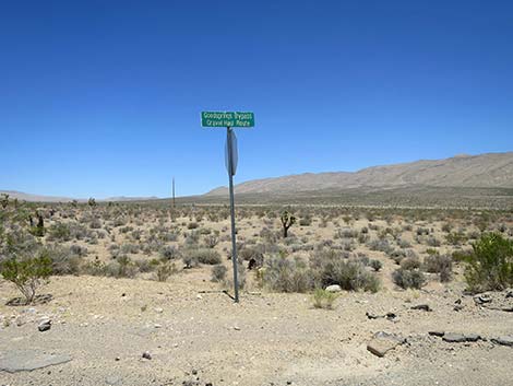 Street sign at the curve (view N) |
 Street sign at the curve (view N) |
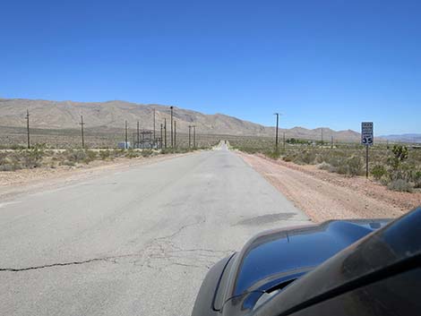 Goodsprings Bypass Rd -- 35 mph speed limit (view E) |
 Goodsprings Bypass Rd approaching a curve right (view E) |
 Goodsprings Bypass Rd curving right (view SE) |
 Gas Pipeline Road returns to the pavement (view SE) |
 Gas Pipeline Road (view E from Goodsprings Bypass Rd) |
 Goodsprings Bypass Rd continues past Gas Pipeline Road (view SE) |
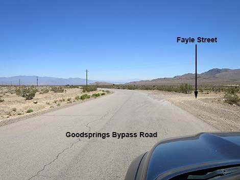 Goodsprings Bypass Rd at Fayle St; shortcut to downtown (view S) |
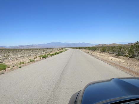
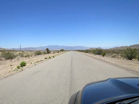 Goodsprings Bypass Road (view SE) |
 Goodsprings Bypass Rd approaching OHV route to downtown (view SE) |
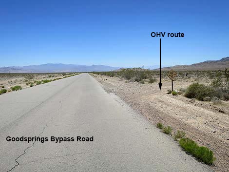 Goodsprings Bypass Rd at OHV route to downtown (view SE) |
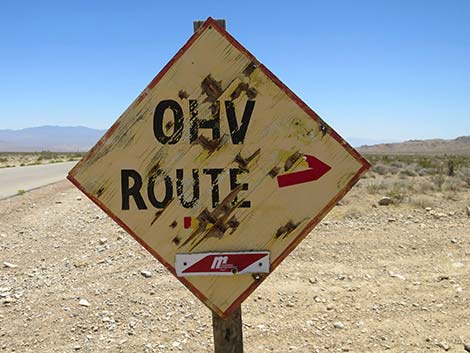 OHV route sign (view SE) |
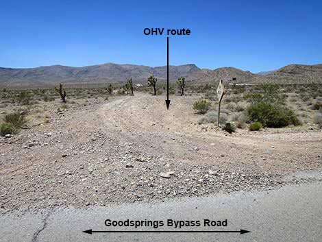 OHV route to downtown (view SE from Goodsprings Bypass Rd) |
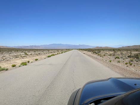
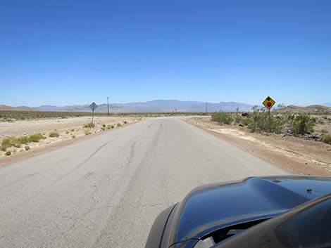
 Goodsprings Bypass Rd continues past OHV route (view SE) |
 Goodsprings Bypass Rd approaching curve to stop sign (view SE) |
 Goodsprings Bypass Rd curving into stop sign (view SE) |
 Goodsprings Bypass Rd ends at Goodsprings Road (view SE) |
 Street sign: Goodsprings Bypass Rd at Goodsprings Road (view SE) |
 Street sign: Goodsprings Bypass Rd at Sandy Valley Road (view SE) |
Table 1. Highway Coordinates based on GPS Data (NAD27; UTM Zone 11S). Download Highway GPS Waypoints (*.gpx) file.
| Wpt. | Location | Latitude (N) | Longitude (W) | Elevation (ft) | Point-to-Point Distance (mi) | Cumulative Distance (mi) |
|---|---|---|---|---|---|---|
| 0849 | Highway 160 at Cottonwood Valley Rd | 640016 | 3984735 | 4,325 | 0.00 | 00.00 |
| 1073 | Cottonwood Valley TH Parking Rd | 640070 | 3984562 | 4,300 | 0.09 | 00.09 |
| 1542 | Cottonwood Rd at Badger TH Rd | 640348 | 3983677 | 4,304 | 0.61 | 00.70 |
| 0850 | Cottonwood Rd at Cottonwood Pass | 640566 | 3980003 | 4,816 | 2.44 | 03.14 |
| 0851 | Cottonwood Rd at Birdspring TH Rd | 640938 | 3979762 | 4,733 | 0.31 | 03.45 |
| 0488 | Cottonwood Rd at 99 Mine Rd (FR-800B) | 641404 | 3978040 | 4,697 | 1.17 | 04.62 |
| 1543 | Cottonwood Rd at Wilson Tank Overlook Rd | 641644 | 3977590 | 4,604 | 0.36 | 04.98 |
| 1544 | Cottonwood Rd at Wilson Tank Rd | 641710 | 3977081 | 4,580 | 0.33 | 05.31 |
| 1931 | Cottonwood Rd at Road FR-800C | 641701 | 3976569 | 4,518 | 0.35 | 05.66 |
| 1368 | Cottonwood Rd at Goodsprings Bypass Rd | 640531 | 3969018 | 3,907 | 5.10 | 10.76 |
Happy Hiking! All distances, elevations, and other facts are approximate.
![]() ; Last updated 250624
; Last updated 250624
| Backroads | Hiking Around Las Vegas | Glossary | Copyright, Conditions, Disclaimer | Home |