Southern Nevada Wilderness Areas, Hiking the Wilderness Areas
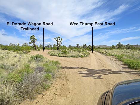 Wee Thump East Rd at turn to El Dorado Wagon Rd Trailhead (view N) |
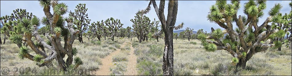
Overview The El Dorado Wagon Road Trail is a 3.0-mile one-way hike that follows an old wagon road that once connected Searchlight and Nipton. The trail parallels Highway 164, but at a respectable distance, as it runs through a forest of Joshua Trees on nearly level terrain inside the southern boundary of Wee Thump Joshua Tree Wilderness Area. This is a point-to-point trail that runs between two trailheads. As such, hikers can walk in either direction, but here the trail is described as running westward. With two vehicles, hikers can walk the trail point-to-point. Otherwise, hikers can walk all the way out and back, making a 6-mile route, or just walk part way out, turn around, and walk back making for a shorter route. This is a nice, easy trail in a scenic area, but louder vehicles on the highway can be heard, so it isn't the purest of wilderness experiences. Link to map. |
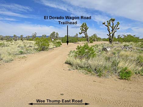 El Dorado Wagon Rd Trailhead (view W from Wee Thump East Rd) |
Watch Out Other than the standard warnings about hiking in the desert, ... this is a fairly safe hike. There are many cactus and other things with sharp points, so be careful walking around. While hiking, please respect the land and the other people out there, and try to Leave No Trace of your passage. This hike goes into Wilderness, so pay particular attention to respecting the land. This hike runs off-trail where nobody will find you, so be sure to bring the 10 Essentials. Cell phones might work, but don't count on it. |
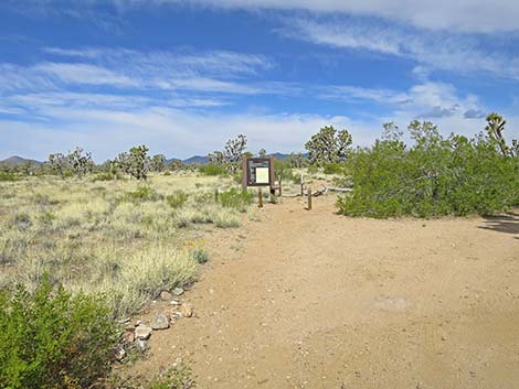 El Dorado Wagon Road Trailhead (view NW) |
Getting to the Trailhead This hike is located in the Wee Thump Joshua Tree Wilderness Area, about 1 hour south of Las Vegas, just west of Searchlight. From town, drive south on Highway 95 to Searchlight (Table 1, Site 0927). In downtown Searchlight, turn right onto Highway 164 (Joshua Tree Highway) and drive west for 8.2 miles to Wee Thump East Road. Turn right and drive north on Wee Thump East Road for 0.5 miles to a pullout on the left (Site 1988). Park here; this is the Wee Thump East Road trailhead. Alternatively, from downtown Searchlight, turn right onto Highway 164 (Joshua Tree Highway) and drive west for 11.1 miles to Spirit of Wilderness Road. Turn right and follow the road about 100 yards to the turn-around loop at the end (Site 1351). Park here; this is the Spirit of Wilderness Trailhead. |
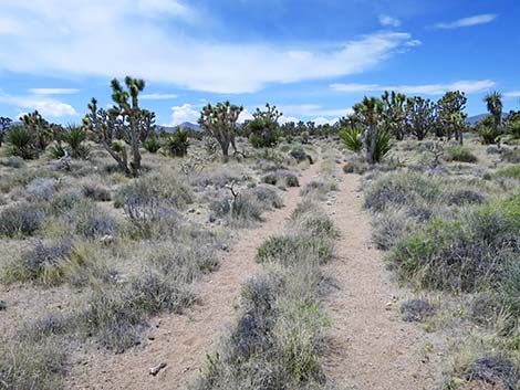
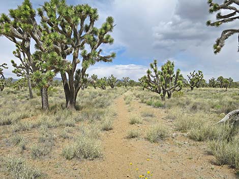 Start of El Dorado Wagon Road Trail (view NW) |
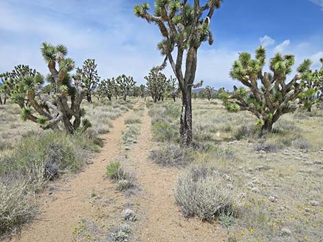
The Hike From the trailhead (Table 2, Waypoint 01), the trail runs northwest past a trailhead sign following the old wagon road. The old wagon road eventually bends a bit left to run more westward through the Upper Sonoran (Mojave Desert Scrub) life zone, which is characterized by Joshua trees mixed with creosote bush, white bursage, lots of other shrub species, and fields of wildflowers in the spring. The area is also thick with buckhorn cholla and Mojave yucca, which make for minor hiking hazards. Keep an eye out for Curve-billed Thrashers and Gilded Flickers, in Nevada found only in this area. For the first mile, the old wagon road is easy to follow, but farther out, it becomes a bit more faint. Nonetheless, the trail continues for 3 miles to the Sprint of Wilderness Trailhead (Wpt. 01) along Highway 164. |
 Start of El Dorado Wagon Road Trail (view NW) |
 Start of El Dorado Wagon Road Trail (view W) |
 Start of El Dorado Wagon Road Trail (view W) |
 Start of El Dorado Wagon Road Trail (view W) |
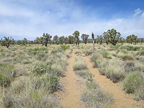
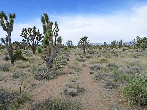
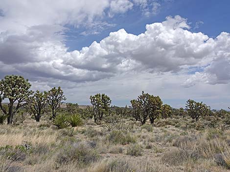 Grand views in the Wilderness Area (view NE) |
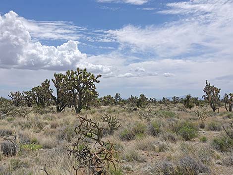 Grand views in the Wilderness Area (view E) |
Table 1. Highway Coordinates Based on GPS Data (NAD27; UTM Zone 11S). Download Highway GPS Waypoints (*.gpx) file.
| Site | Location | UTM Easting | UTM Northing | Latitude (N) | Longitude (W) | Elevation (ft) |
|---|---|---|---|---|---|---|
| 1007 | Spirit of Wilderness TH Parking | 671865 | 3931555 | 35.51451 | 115.10480 | 4,545 |
| 1299 | Hwy 164 at Wee Thump East Rd | 676340 | 3930808 | 35.50699 | 115.05564 | 3,960 |
| 1351 | Hwy 164 at Spirit of Wilderness Road | 671916 | 3931605 | 35.51495 | 115.10423 | 4,567 |
| 1352 | Wee Thump Corral | 676427 | 3931116 | 35.50975 | 115.05462 | 4,129 |
| 1988 | Wagon Road Trailhead | 676363 | 3931581 | 35.51396 | 115.05522 | 4,161 |
Table 2. Hiking Coordinates Based on GPS Data (NAD27; UTM Zone 11S). Download Hiking GPS Waypoints (*.gpx) file.
| Wpt. | Location | UTM Easting | UTM Northing | Elevation (ft) | Point-to-Point Distance (mi) | Cumulative Distance (mi) |
|---|---|---|---|---|---|---|
| 01 | Trailhead (Wee Thump East Road) | 676362 | 3931571 | 4,160 | 0.00 | 0.00 |
| 02 | Trail-End (Highway 164) | 671915 | 3931600 | 4,568 | 2.99 | 2.99 |
Happy Hiking! All distances, elevations, and other facts are approximate.
![]() ; Last updated 240602
; Last updated 240602
| Hiking Around Wilderness Areas | Hiking Around Las Vegas | Glossary | Copyright, Conditions, Disclaimer | Home |