Hiking Southern Nevada Wilderness Areas, Backroads
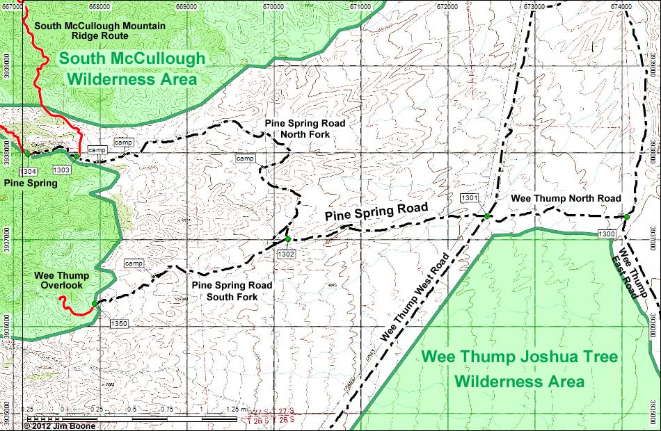
Note: Map based on USGS 7.5-minute topo map, which may have red grid lines and various numbers. North is at the top. Grid is UTM NAD27 CONUS. Roads are black (solid = paved; dashed = unpaved; width implies quality). Trails and routes are red (solid = main; dashed = adjacent or alternate). Washes, streams, and lakes are blue (solid = permanent; dashed = intermittent). National Monument Areas (boundaries dash-dot green, fill light green) based on BLM data. Wilderness Areas (boundaries solid green, fill light green) based on BLM data. Download waypoint coordinates from route description page.
Happy Hiking! All distances, elevations, and other facts are approximate.
![]() ; Last updated 250419
; Last updated 250419
| Pine Spring Road, South Fork | Hiking the Wilderness Areas | Glossary | Copyright, Conditions, Disclaimer | Home |