Hiking Around Las Vegas, Lake Mead NRA, Bridge Mountain Wilderness Area
 Sign (view N from Christmas Tree Pass Road at Grapevine Road) |
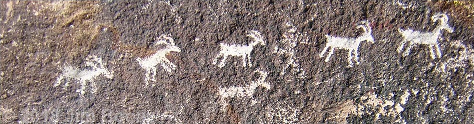
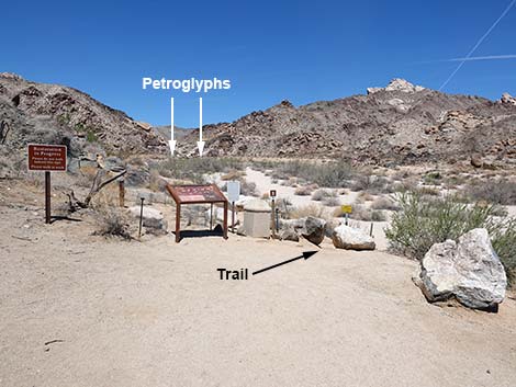
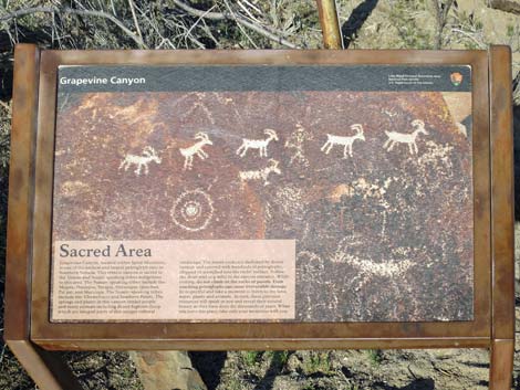
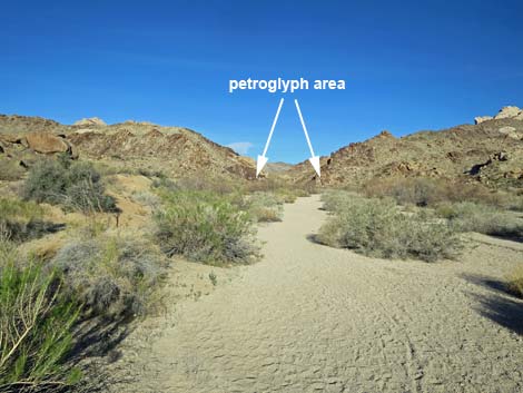
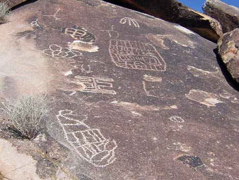
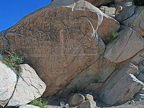
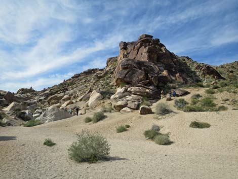
Overview: The Grapevine Canyon Petroglyph Trail leads to an amazing collection of rock-art, or "rock stories" as some native people would say, that were created by ancient people who lived among these rocky canyons thousands of years ago. The rock stories depict abstract forms, the meaning of which has been lost to time, and representational forms such as bighorn sheep and humans. The Grapevine Canyon Petroglyph Trail departs from the far end of the parking lot, immediately drops into the wash, and follows the wash upstream for 0.3 miles to rocky crags at the entrance to Grapevine Canyon. The walking is technically easy, but the sand in the wash is soft. Most of the rock stories were written on the rocky outcrops at the entrance to the canyon. For more adventuresome hikers, the Grapevine Canyon Waterfall route runs 1.7 miles up the rocky canyon into granite mountains (unusual for the Las Vegas area) following a seasonal stream past stands of cottonwood trees and water-sculpted narrows to a nice 15-foot waterfall with a bathtub. Link to map. |
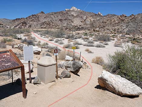
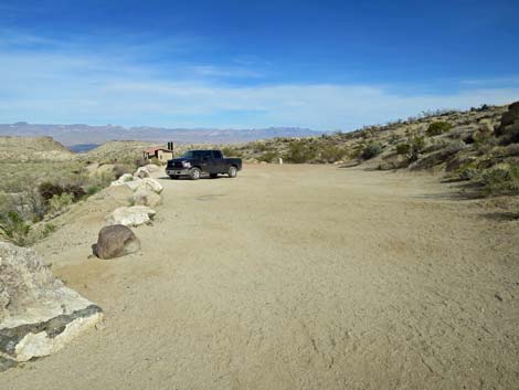
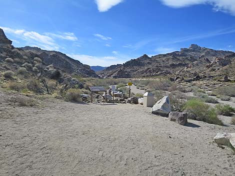 Trailhead at the far end of the parking area (view W) |
Watch Out Other than the standard warnings about hiking in the desert, ...this hike is fairly safe, but for those of us used to walking on rough, almost sticky, limestone and sandstone, the water-polished granite is surprisingly slick. There is a fair bit of scrambling over and around boulders and walking on granite slickrock, so be careful when you get high enough to fall and hurt yourself. While hiking, please respect the land and the other people out there, and try to Leave No Trace of your passage. Also, this is a fairly short hike, so just bring what you need of the 10 Essentials. This hike goes into the Bridge Mountain Wilderness Area, so pay extra attention to respecting the land, and don't touch or otherwise mess with the petroglyphs. |
 Approaching the trailhead (view W) |
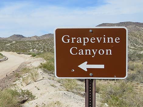
Getting to the Trailhead This hike is located near Laughlin, about 75 miles south of Las Vegas (7 miles west of Laughlin). From Las Vegas, drive south towards Laughlin to Christmas Tree Pass Road, off Highway 163. Watch for a small sign indicating a left turn. This point is 6.7 miles before the bridge in Laughlin. There is no turn lane, so consider stopping on the right shoulder and waiting for traffic to clear before making the left turn. Turning onto Christmas Tree Pass Road, drive north 1.8 miles to Grapevine Canyon Road. Turn left onto Grapevine Canyon Road and drive west 300 yards to the end of the road. Park here; this is the trailhead. |
 Trailhead (view NW) |
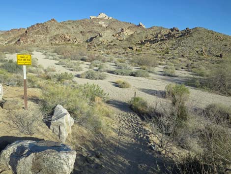
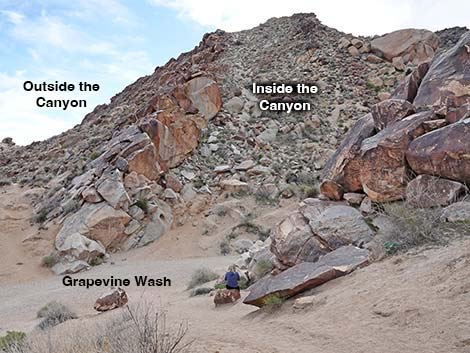
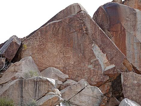
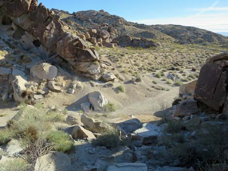
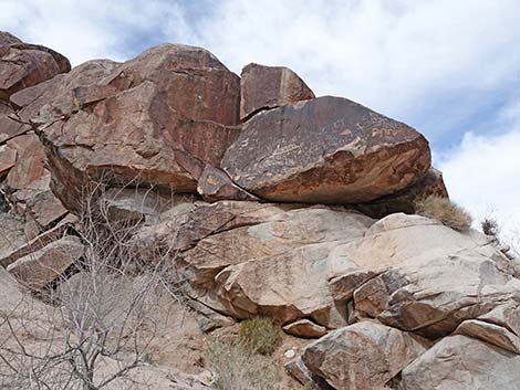
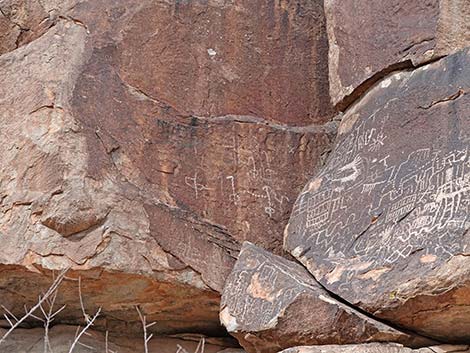
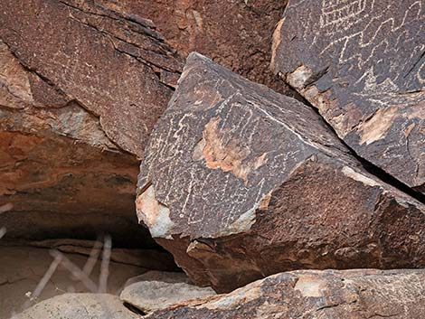
The Hike From the trailhead (Table 1, Waypoint 01), a trail drops into Grapevine Wash. The trail runs west (uphill) for 0.27 miles to a gap in the cliffs where Grapevine Wash comes out of Grapevine Canyon (Wpt. 02). There is an amazing number of petroglyphs on the granite walls on both sides of the gap. There are some nice petroglyphs at eye-level right where the trail gets to the cliffs, but there are better ones a few feet higher up the cliffs on both sides of the canyon. Most of the petroglyphs is within a 1-minute walk of the gap, but petroglyphs are scattered farther up the canyon. Be careful if climbing on the cliffs to see petroglyphs up close. Don't fall, and also don't climb on the petroglyphs. These are treasures from a time gone by, and all of us are responsible for taking care of them today. When ready, either continue up the canyon or return to the trailhead (Wpt. 01) by following your footprints back down the wash. |
 Trailhead sign: sacred area (view NW) |
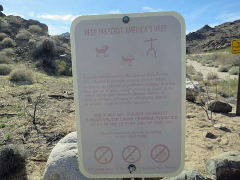 Trailhead sign; protect America's past (view NW) |
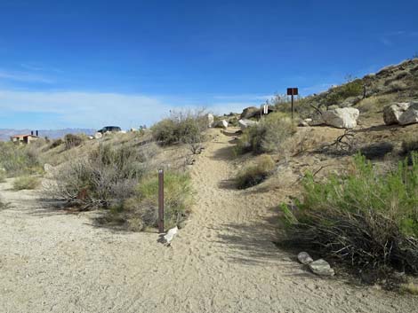
 The trail descends into the wash (view NW) |
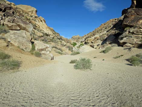
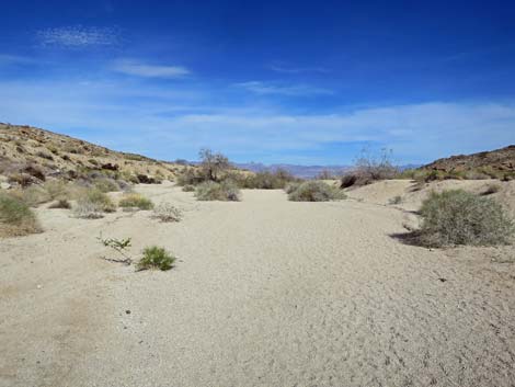
 In the wash, the trail heads uphill (view N) |
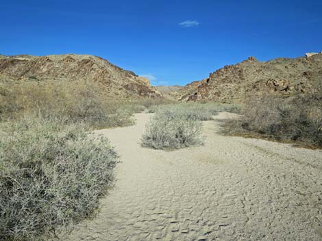 Trail in the wash (view N) |
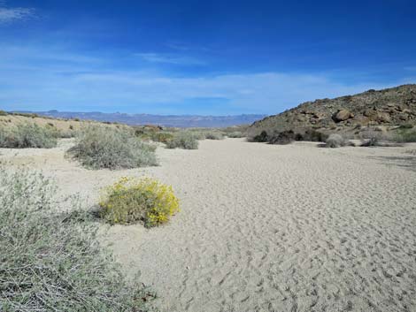
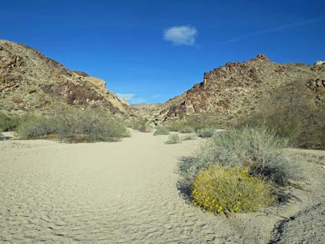 Trail in the wash with blooming Brittlebush (view N) |
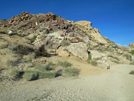
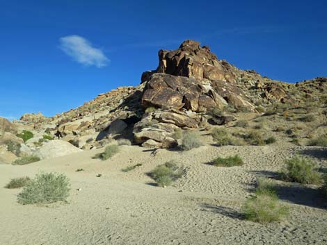
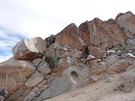
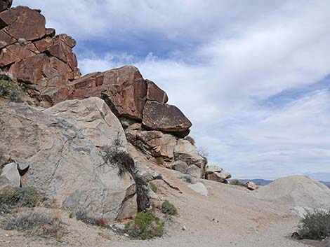
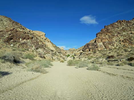 Approaching entrance to the canyon (view W) |
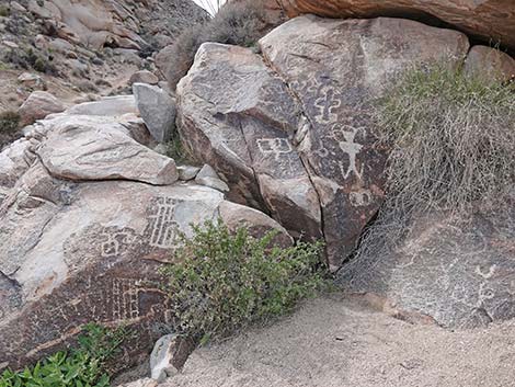
 Entrance to the canyon (view W) |
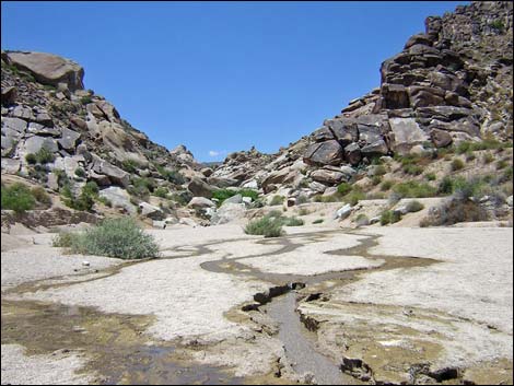 Entrance to the canyon during wet spring (view W) |
 Mouth of the canyon during wet spring (view W) |
 Entrance to the canyon: south side (view W) |
 Entrance to the canyon: north side (view W) |
South Side of the Canyon Entrance
 South side of the canyon (view S from the north side) |
 South side, outside the canyon (view SW) |
 Outside canyon entrance |
 Outside canyon entrance |
 Outside canyon entrance |
 Outside canyon entrance (view SW) |
 South side of the canyon, inside mouth of canyon (view SW) |
 South side of the canyon, inside mouth of canyon (view S) |
 Inside entrance to the canyon (view SE) |
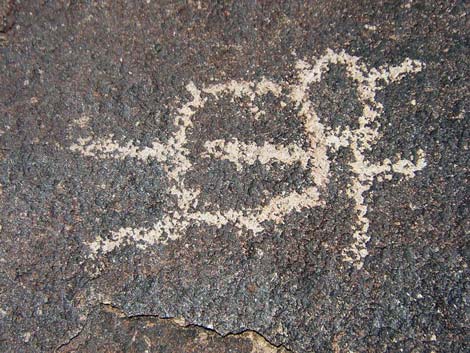
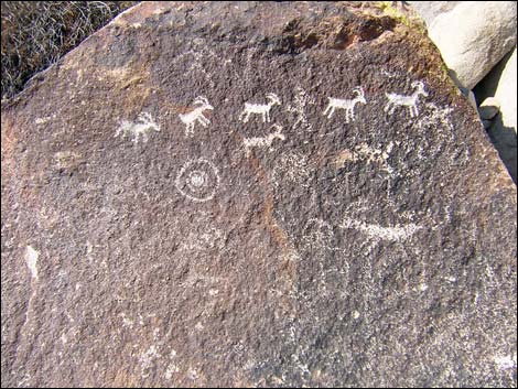
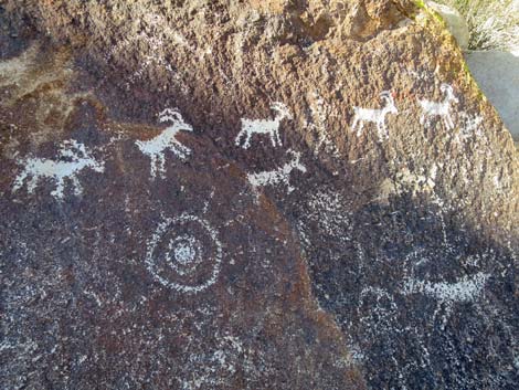
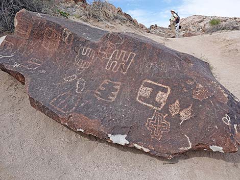
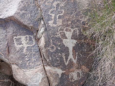
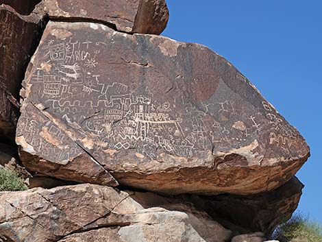
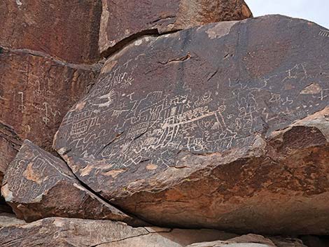
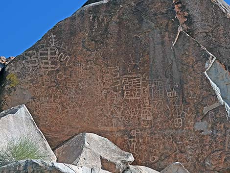 Petroglyph panel closeup |
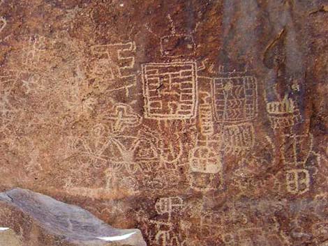 Petroglyph panel closeup, right side |
 Inside entrance to the canyon (view SE) |
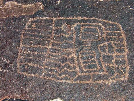
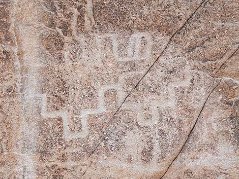 Petroglyph panel closeup |
 Inside entrance to the canyon (view SW) |
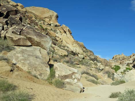
 Inside the canyon (view S) |
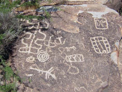
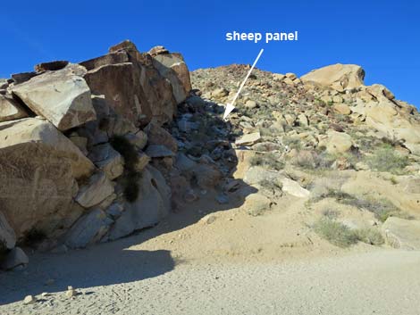
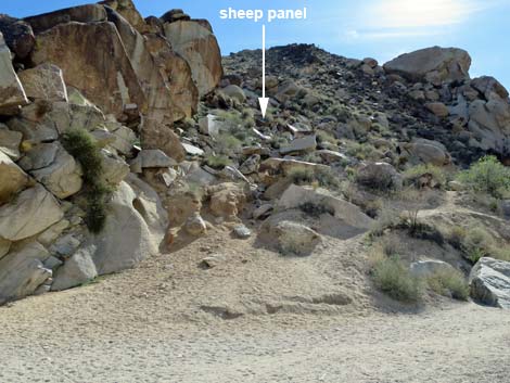
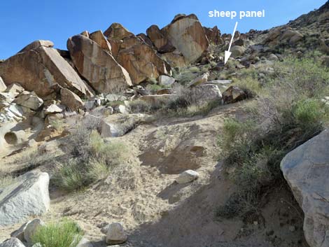
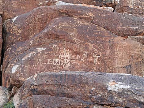
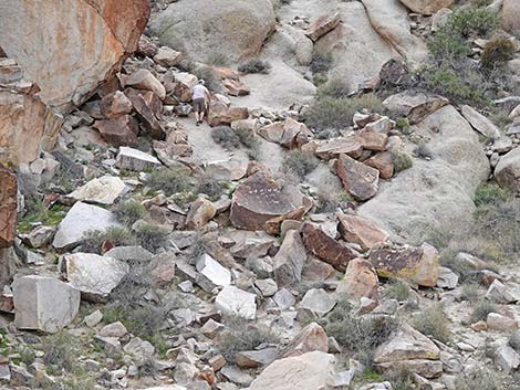 Sheep panel (view S from N side of canyon) note hiker for scale |
 Sheep panel (view S from N side of canyon) |
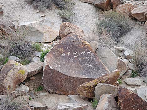
 Sheep panel rock (view S) |
 Sheep panel rock, close-up (view S) |
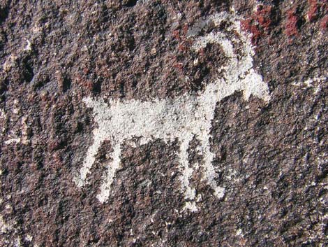 Sheep panel rock (view S) |
North Side of the Canyon Entrance
 North side of the canyon (view NW from south side of wash) |
 North side of the canyon (view NE from S side) |
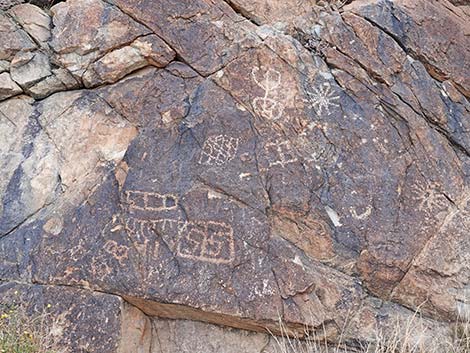
 Petroglyphs on boulder at ground level (view N) |
 |
 |
 |
 |
 |
 Inside entrance to the canyon (view E) |
 Inside entrance to the canyon (view NE) |
 Inside entrance to the canyon (view NE) |
 Inside entrance to the canyon (view NE) |
 |
 |
Returning to the Trailhead
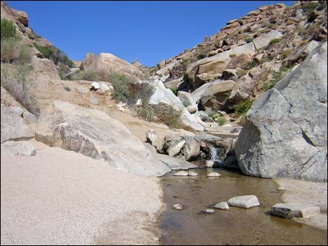
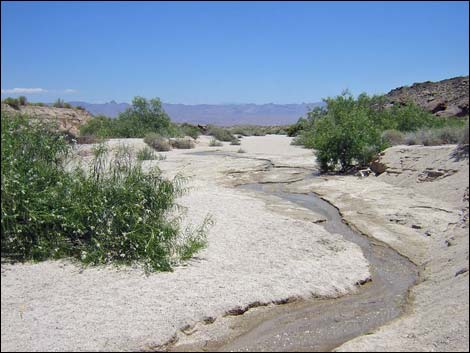 Creek flowing from mouth of the canyon after a wet winter (view E) |
 Creek disappearing into the desert sands after a wet winter (view E) |
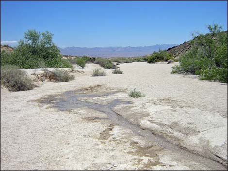
 Heading down the dry wash (view E) |
 Heading down the dry wash (view E) |
 The trailhead comes into view (view E) |
 Approaching the trailhead (view SE) |
 Trail exits the wash (view SE) |
 Back to the trailhead parking area (view E) |
Table 1. Hiking Coordinates Based on GPS Data (NAD27; UTM Zone 11S). Download Hiking GPS Waypoints (*.gpx) file.
| Wpt. | Location | UTM Easting | UTM Northing | Elevation (ft) | Point-to-Point Distance (mi) | Cumulative Distance (mi) |
|---|---|---|---|---|---|---|
| 01 | Grapevine Canyon Trailhead | 711051 | 3900358 | 2,366 | 0.00 | 0.00 |
| 02 | Petroglyphs | 710645 | 3900478 | 2,420 | 0.27 | 0.27 |
| 01 | Grapevine Canyon Trailhead | 711051 | 3900358 | 2,366 | 0.27 | 0.54 |
Happy Hiking! All distances, elevations, and other facts are approximate.
![]() ; Last updated 240604
; Last updated 240604
| Hiking Around Lake Mead | Hiking Around Las Vegas | Glossary | Copyright, Conditions, Disclaimer | Home |