Hiking Around Las Vegas, Lake Mead National Recreation Area
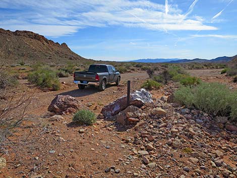
 Mile 18.2 Trailhead |
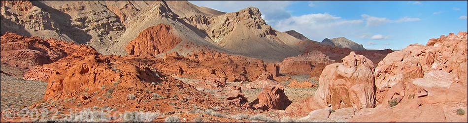
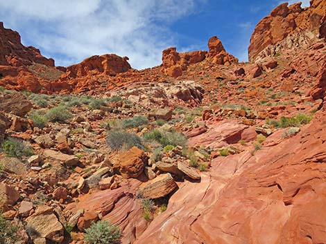
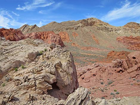
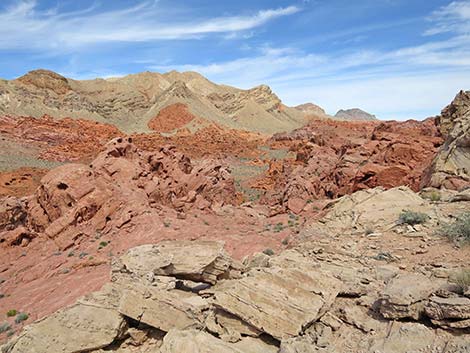
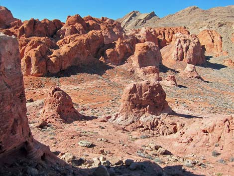
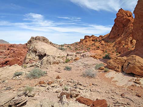
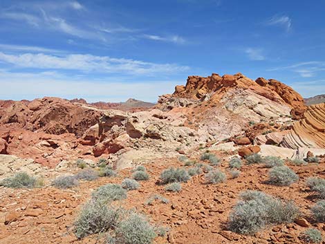
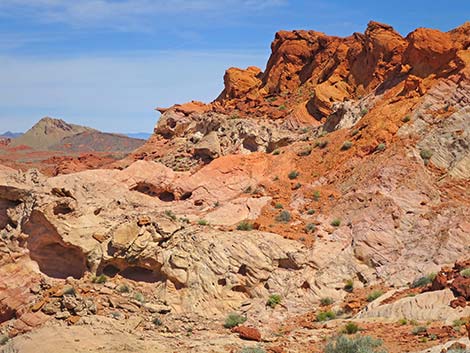
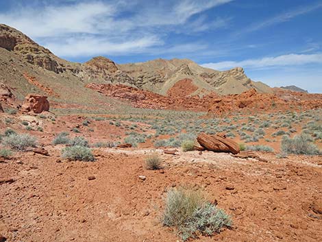
Overview The Bowl of Fire Southwest (BOF SW) Loop is a moderate, entirely off-trail hike inside the Muddy Mountains Wilderness Area where brilliant-red Jurassic-Age sandstone outcrops are surrounded by gray limestone mountains. The limestone forms the sides of the bowl, and the red sandstone forms the fire in the bottom. The BOF SW Loop has two trailheads: one for 2WD vehicles and another for 4WD vehicles. The BOF SW Loop makes a lollipop-style loop around the BOF SW area. Hikers can go in either direction, but as described here, the loop goes clockwise. The route enters the BOF at the Blue Pour-Over, then stays left scrambling up through the southern section to a saddle on the main BOF ridge. The saddle makes a nice place for lunch with a view. From Lunch Ledge, the route descends into the valley beyond. Now following the valley north, the route climbs over a low saddle and follows the drainage system back to Blue Pour-Over and the trailhead. Link to map. |
 Hiker departing trailhead (view N; evening light) |
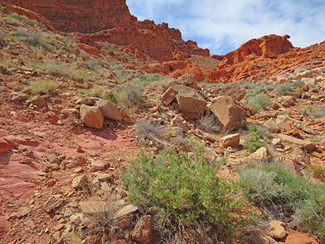
Watch Out Other than the standard warnings about hiking in the desert, ...this is fairly safe hiking area if you stay in the washes that dissect the sandstone outcrops. There are several pour-overs to navigate, and there is a lot of loose material on the ground, including Moki marbles (like ball bearings under your feet). The outcrops are inviting, however; so for those who climb on the rocks, watch your step and watch your kids. This is a backcountry area, so rescue would be time consuming and fairly difficult. It would be easy to get turned around in the maze of side canyons and boulder piles, so if you get "lost," just hike down any wash (always go downhill) and you will come out onto Callville Wash Road. I got 5G cell service atop Lunch Ledge. While hiking, please respect the land and the other people out there, and try to Leave No Trace of your passage. Also, this hike is moderately long, so be sure to bring the 10 Essentials. This hike goes into the Muddy Mountains Wilderness Area, so pay particular attention to respecting the land. |
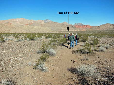
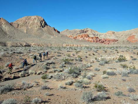
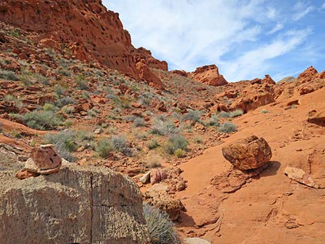
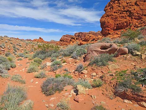
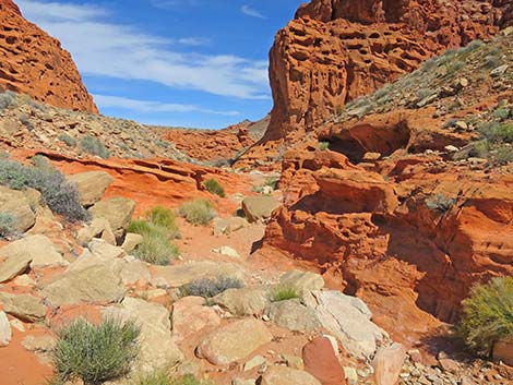
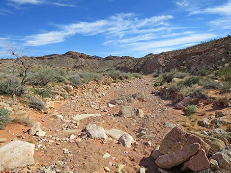
 Hikers crossing the Toe of Hill 651 |
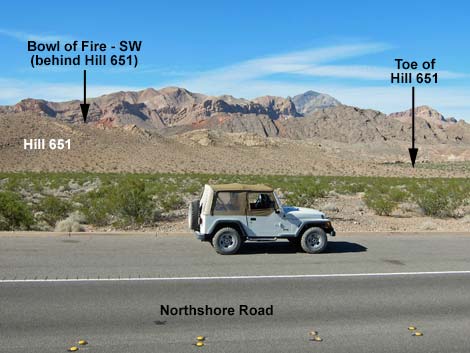
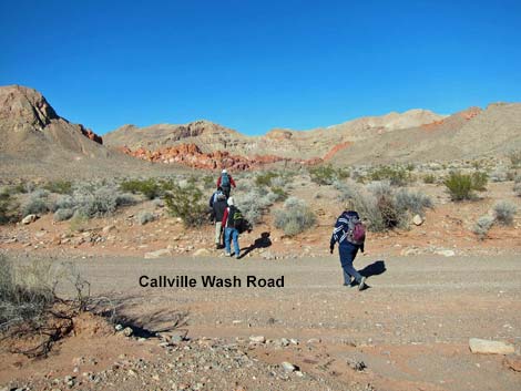
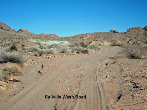
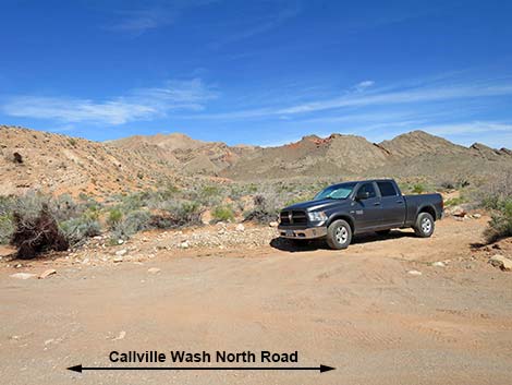
Getting to the Trailhead This hike is located along Northshore Road in Lake Mead National Recreation Area, about 45 minutes northeast of Las Vegas. From town, drive out to Lake Mead. In a 2WD vehicle, drive north on Northshore Road to Mile 18.2 Trailhead. Park here; this is the 2WD trailhead. In a 4WD vehicle, drive north on Northshore Road to the Mile 16.0 (Anniversary) Trailhead. Turn left into the dirt and drive up Callville Wash North Road (Road 94) for about 1.8 miles to the mouth of a large wash that comes in from the left (Site 0786). Park here; this is the Bowl of Fire Wash trailhead parking. For hikers using the 4WD Trailhead, see Bowl of Fire -- Southwest, 4WD Trailhead and Approach. |
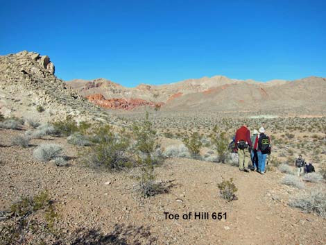
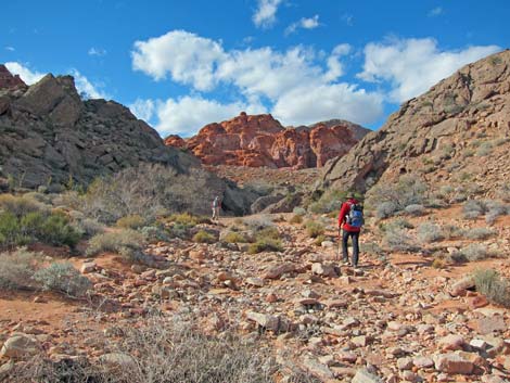
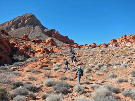
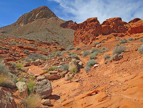
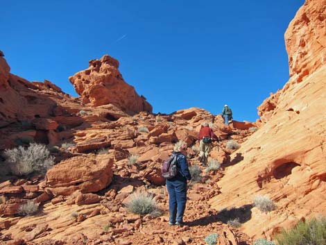
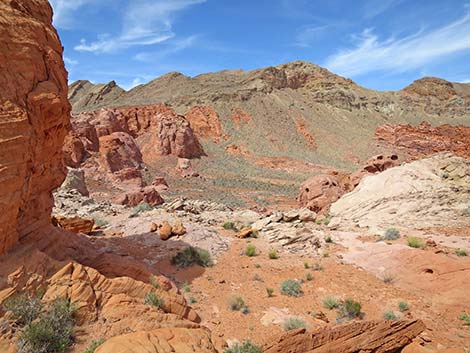
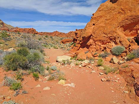
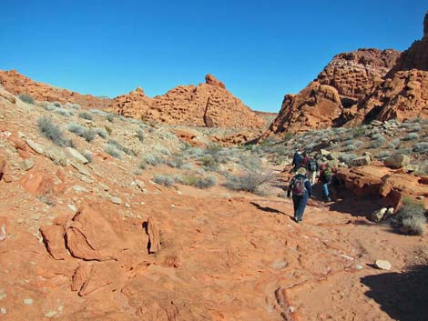
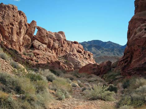
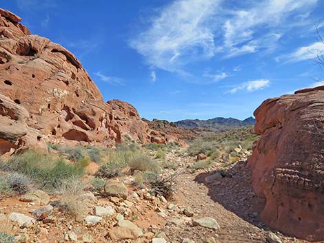
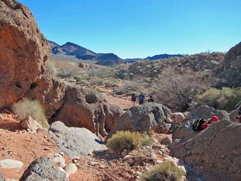
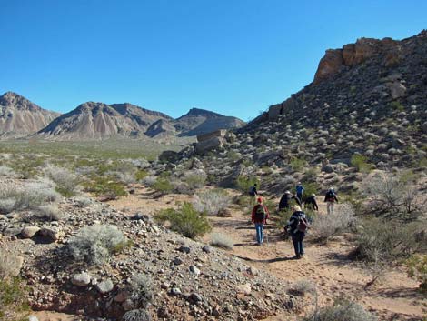
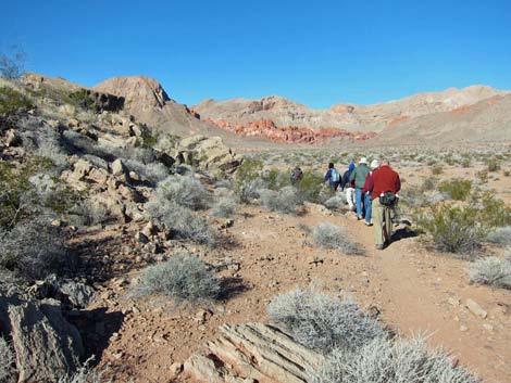 Hikers wrapping around the Toe of Hill 651, BOF comes into view |
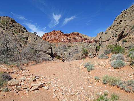
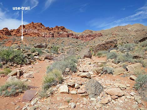
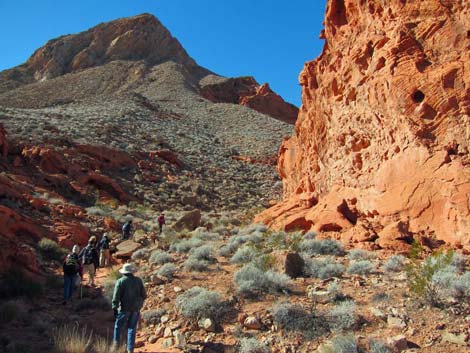
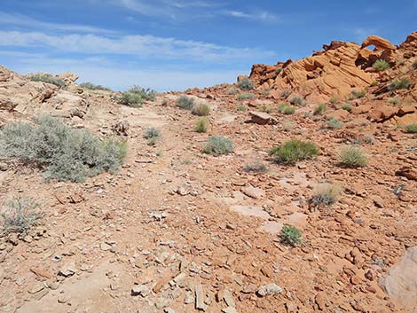
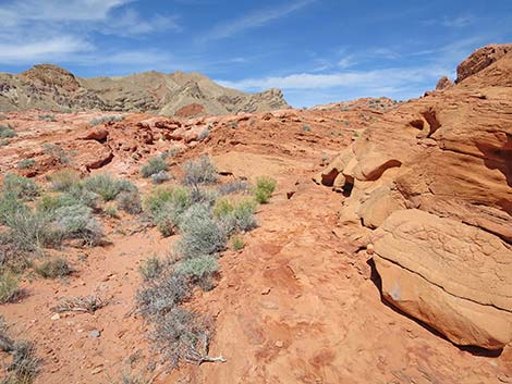
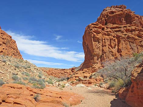
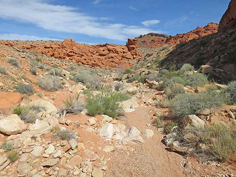
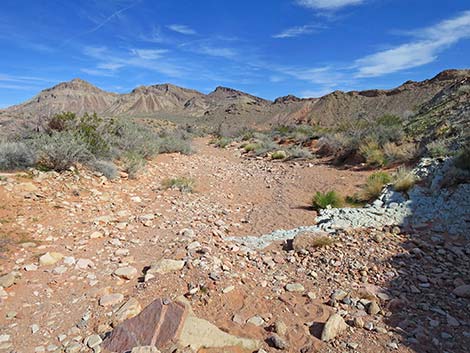
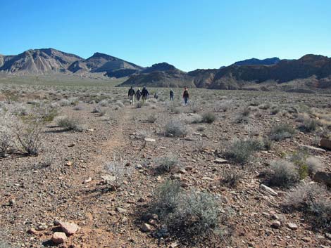
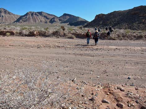
The Hike From the Mile 18.2 Trailhead (Table 1, Waypoint 01), the hike runs north across the open desert towards the northern toe of Hill 651 (Wpt. 02). There is no trail until the route nears the toe of Peak 651, but then a use-trail wraps around the south side of the hill. The use-trail fades away past the toe; but from there, the route runs northwest across Callville Wash and heads towards the red sandstone crags that can be seen ahead in the Bowl of Fire. Hikers can look for a use-trail that runs towards the entrance to the Bowl of Fire. Crossing the desert flats, the use-trail hits Bowl of Fire Wash just below an outcrop of red rocks (Wpt. 03). Dropping into the wash, the route runs upstream about 50 yards and passes through a narrow area between rocky bluffs where the wash bends hard to the left (south). The wash forks at this point, and the route stays left in the main fork. |
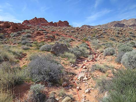
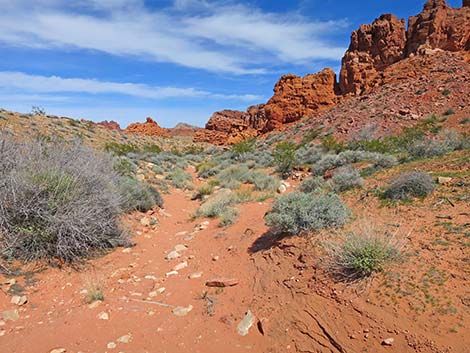
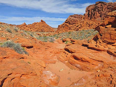
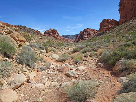
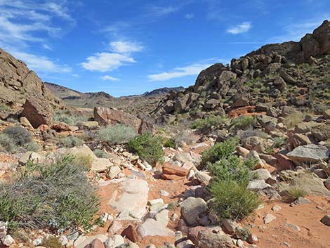
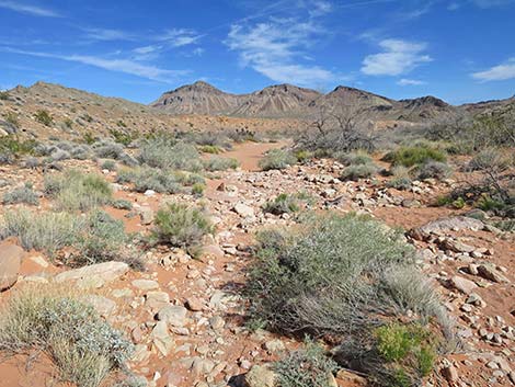
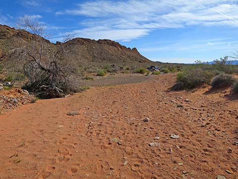
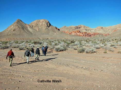 Hikers crossing the first part of Callville Wash |
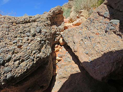
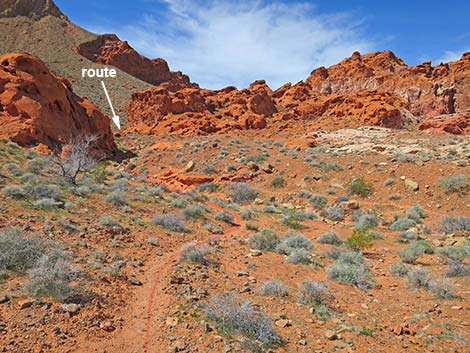
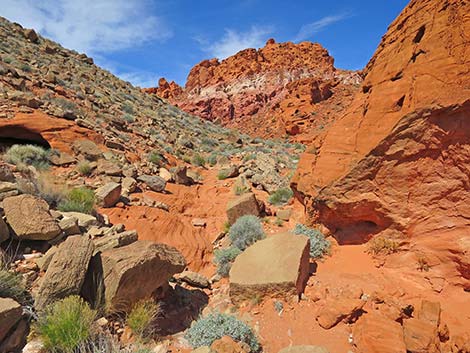
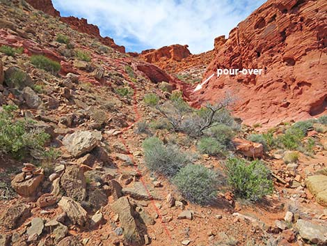
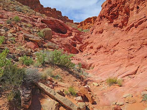
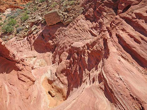
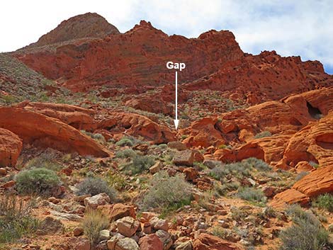
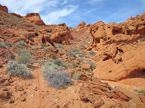
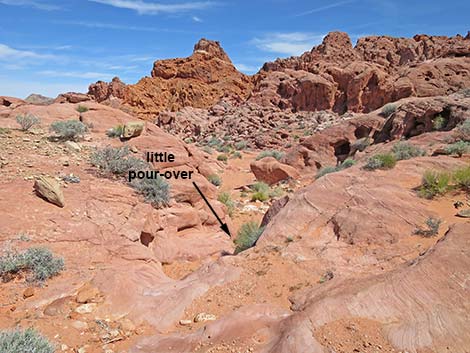
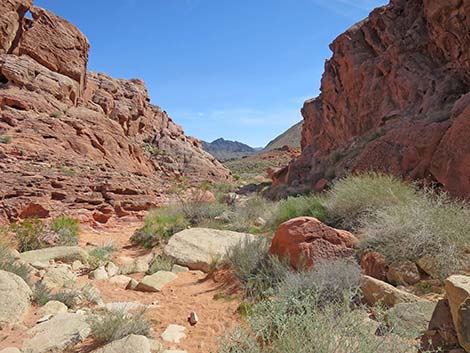
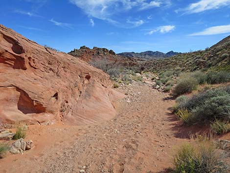
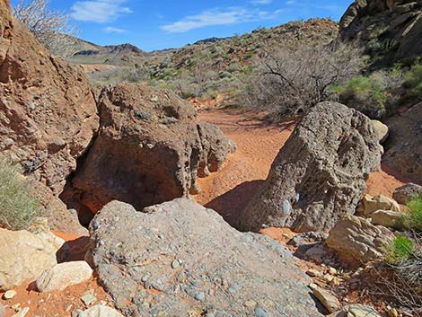
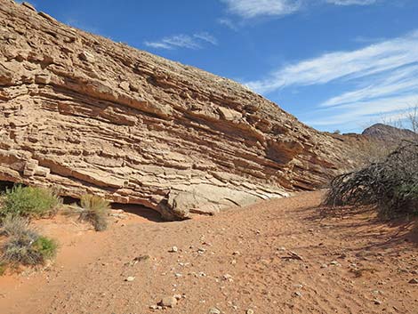
The wash runs another 350 yards and eventually narrows again. Here, the canyon walls rise as the wash runs through a gap (Wpt. 04) in a limestone ridge. At the narrow gap (Wpt. 04), the wash cuts through a layer of gray conglomerate rock where a jumble of boulders creates a small pour-over that is most easily passed towards the right. The conglomerate is composed of coarse limestone fragments set in a matrix of smaller limestone fragments, which is interesting enough, but where it was polished by flowing water, the color is blue and very pretty, hence the Blue Pour-Over. Above the Blue Pour-Over (Wpt. 04), hikers are inside the BOF SW. Here, the wash forks again. The main wash bends north (right) following the base of the ridge on the right, making it easy to overlook the other wash, which comes in from the southwest (left). Here, just above the Blue Pour-Over, the regular BOF SW route and the BOF SW Loop route separate. |
 Hikers crossing the second part of Callville Wash |
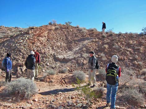
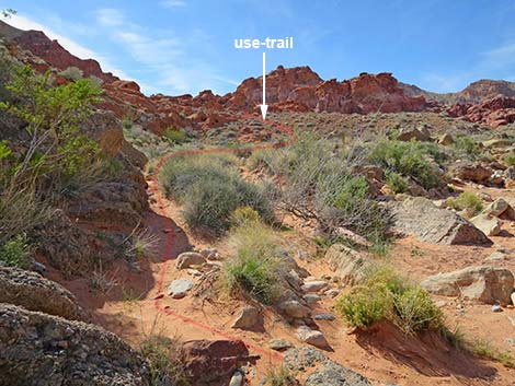
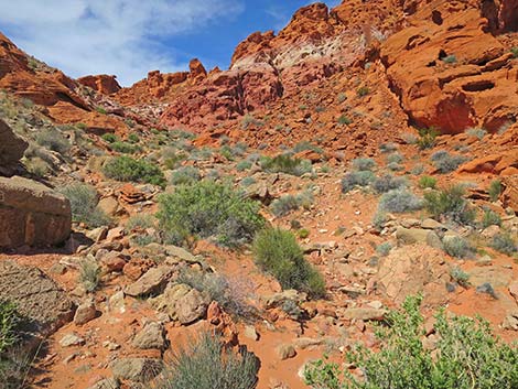
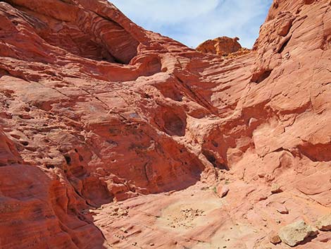
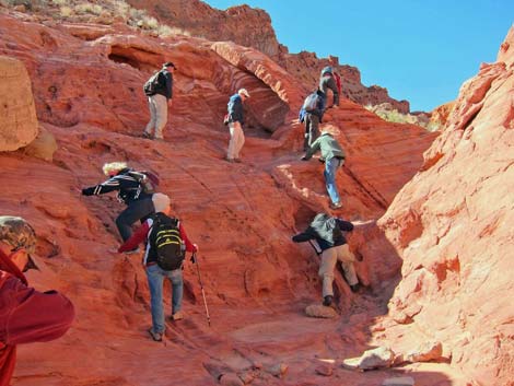
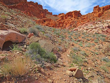
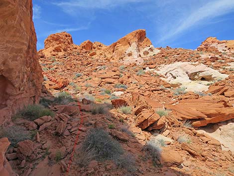
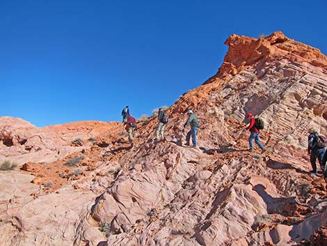
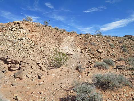
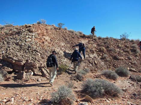
Following the use-trail, which is intermittent all the way up to the ridgeline, hikers stay in the wash bottom or along the wash, passing against a tall, vertical cliff on the right side of the wash. Before long, hikers arrive at a 15-ft high pour-over (Wpt. 05), which is easily passed on the south (left) side. Hikers can scramble directly up the pour-over, or starting several yards back, they can follow a steep, narrow use-trail that stays, more or less, on the rocky dirt slope above the bare sandstone. Above the 15-ft pour-over, a fair use-trail depart the wash bottom, staying farther left on the sideslope than one might expect, as it climbs steeply up the hillside and through a cleft in the sandstone cliffs above. The cleft is easier to climb than it appears from below. |
 Callville Wash Road (view NE up the road) |
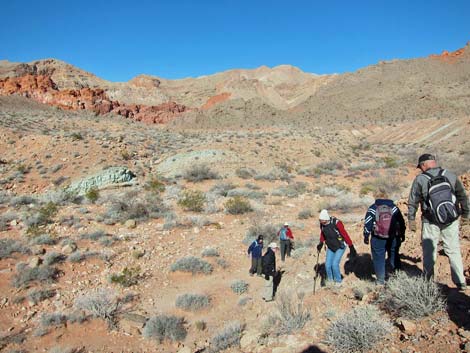
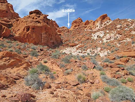
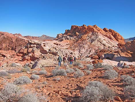
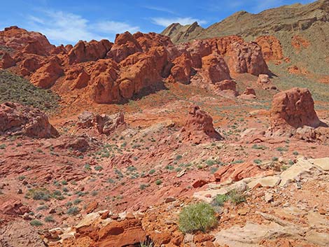
Above the cleft, the route turns right and runs west above the sandstone cliffs. The route heads up the canyon following the line of least resistance, initially running between low cliffs. The left cliff provides a nice place to stop in the shade on a hot summer day. Passing between these cliffs, the route angles slightly right to follow very faint use-trails straight up the rocky slope to a saddle (Wpt. 06). The saddle opens onto Lunch Ledge (Wpt. 07) where hikers get a great panorama stretching from Lake Mead to the south, around past the limestone ridges of Anniversary Peak, and into the North Bowl of Fire. From Lunch Ledge (Wpt. 07), hikers can turn north on the ledges, climb over a low ridge on a use-trail, and descend into a narrow gully that leads to the canyon bottom below. Alternatively, hikers can turn south on Lunch Ridge and follow a well-used use-trail that descends the sideslope into the valley below. The route to the south is a bit longer, but it is a more pleasant route. |
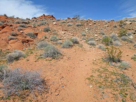
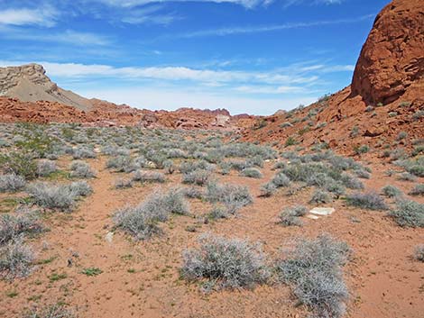
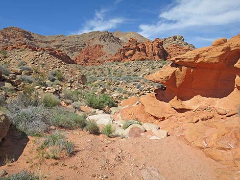
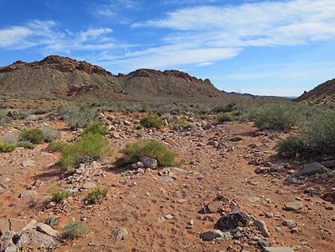
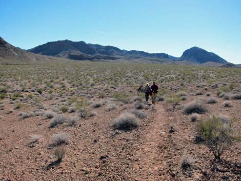
 Hikers crossing desert flats (view NW) |
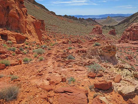
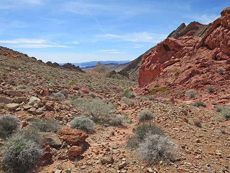
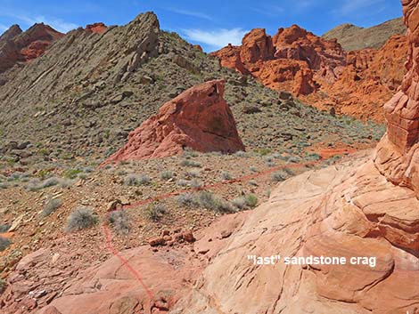
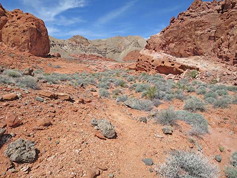
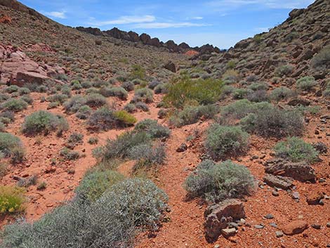
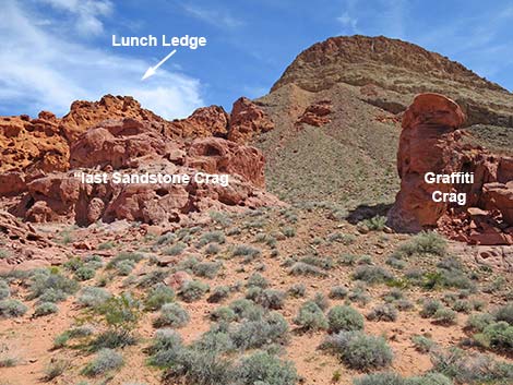
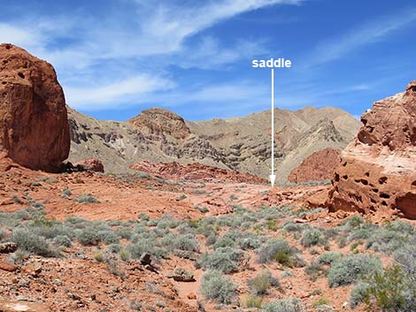
Heading south, the use-trail comes and goes, but it coalescences around the base of what appears to be the last isolated crag on the right. Turning this corner to the west, hikers can see in the near distance, a use-trail in the bottom of the canyon. Turning right between this crag and what turns out to be the last crag, hikers descend a faint use-trail, cross the small wash, and arrive at the use-trail (Wpt. 08) that runs up the valley bottom. Turning north, the use-trail follows the valley bottom towards a low rise (Wpt. 09), which actually is the main saddle behind the BOF SW. On slickrock, the use-trail disappears, but hikers should stay somewhat left towards the lowest point on the saddle. I had 5G cell service here. The route continues over the saddle, following a faint use-trail down the sandy canyon. The use-trail eventually merges into the main wash in the bottom of the canyon and arrives at the first little pour-over. At this point, the route re-enters the sandstone crags area. |
 Hikers dropping into the wash; note green cliff in background |
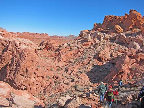
A few minutes farther, the route arrives at a 6-ft pour-over (Wpt. 10), which is easily bypassed on ledges to the right. Why do pour-overs always look so much higher from above? A bit farther down the wash, another wash (Wpt. 11) merges from the left. For hikers who used the more direct route down from Lunch Ledge, this is where it reaches the wash bottom and the two alternative merge. Continuing down the canyon, the wash takes an abrupt turn to the left, as if to start heading upstream, but this is the confluence of three washes (Wpt. 12), and the route turns hard to the right to continue downstream. For hikers doing the loop in the other direction and going upstream here, this could be a point of confusion. The two washes to the right are clearly bordered by limestone alluvium, but the wash to the left is bordered by red sandstone. |
 Hikers in the wash, looking back up the steep descent (view SE) |
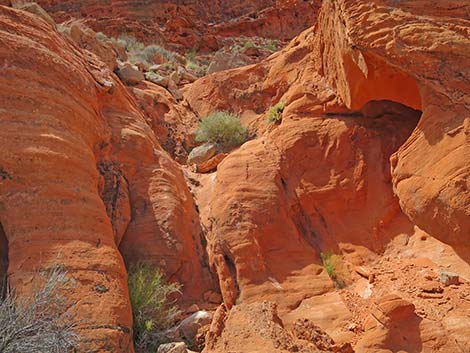
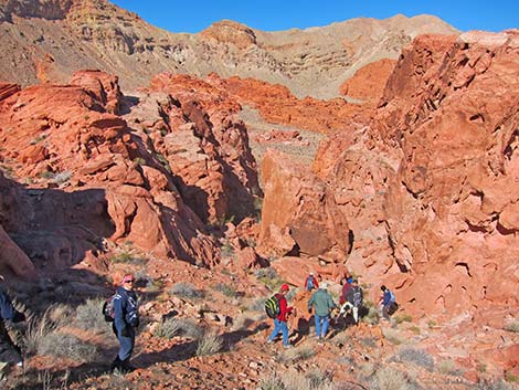
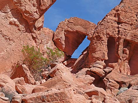
Continuing downstream, the wash passes through a gorge between two tall cliffs. The cliff on the right probably provides nice shade all year. Beyond the gorge, the canyon runs up to a red sandstone wall (Wpt. 13) and bends southeast. Now running nearly straight, the wash runs down between sandstone crags that tower above. This is the exit wash, and hikers need only hike downhill to find their way out of BOF SW. The route passes a confluence (Wpt. 14) where a major wash merges from the left. Hikers could use this wash to hike over to BOF North. Continuing downhill, the route runs below more towering sandstone crags, one with a nice arch on the left. As the wash seems to exit the sandstone crags area, the sides of the wash become alluvial materials rather than sandstone. |
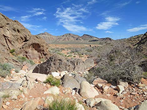
 Route runs up BOF Wash (view NW) |
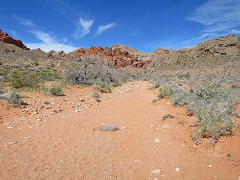
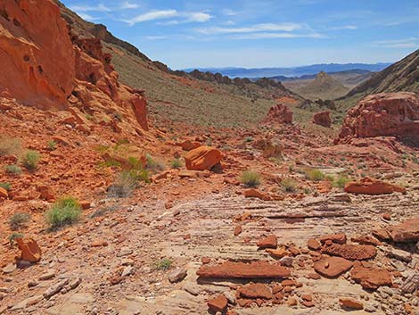
The main wash runs southeast, more or less straight, until bending left to run east for about 50 yards. At this point, the wash runs up against another cliff (Wpt. 15) and bends right to run southeast again. At the cliff, another major wash merges with the main wash. For hikers heading to BOF North, this is the wash to use. Continuing down the main wash for another 0.14 miles, the route returns to the Blue Pour-Over (Wpt. 04), closing the loop. Below the Blue Pour-Over, the wash runs more or less straight southeast, passing over interesting blue layers of volcanic ash in the bed of the wash. At about 0.21 miles below the Blue Pour-Over, the wash again runs up against a cliff and changes directions, this time to the right. |
 BOF Wash approaching entrance to BOF SW (view NW) |
At this bend, hikers heading to the 4WD Trailhead should cut the corner tight, passing along a nice outcrop of blue volcanic ash and continuing down the wash for about 0.32 miles to the trailhead. At this bend, hikers heading to Mile 18.2 Trailhead should take the corner wide, staying out against the cliff on the far side. From the corner, the trail runs southwest for about 50 yards to the steep use-trail that cuts up out of the wash. On desert flats above the wash, hikers can see Hill 651. Use-trails lead to the northern tip of Hill 651, then wrap round the tip and run almost due south to the trailhead. |
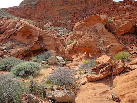
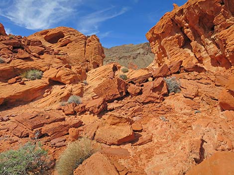
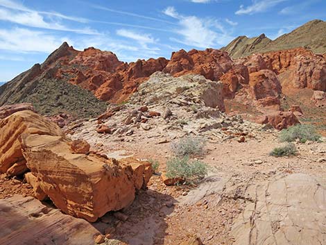
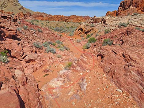
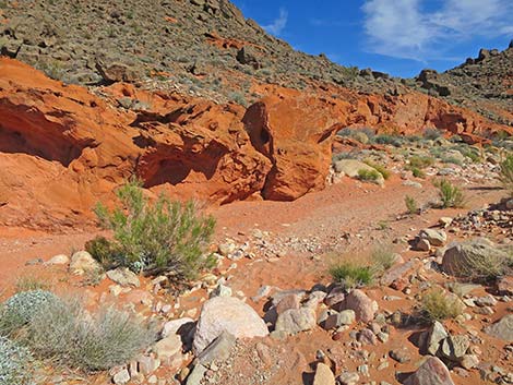
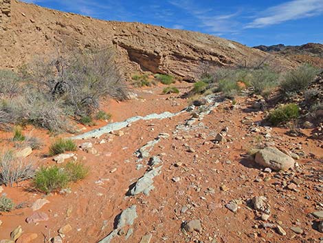
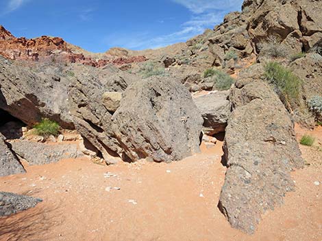 Jumble of boulders at the Blue Pour-Over (view NW) |
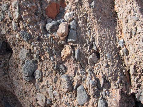 Details of the conglomerate boulders |
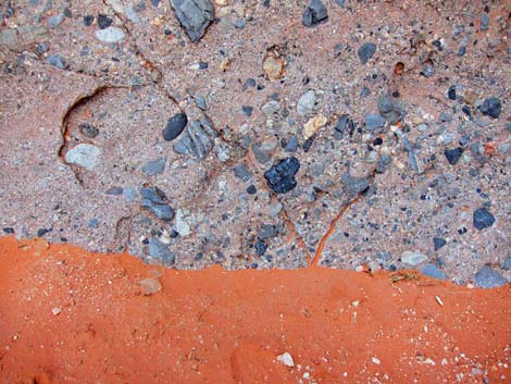 Conglomerate boulder and red sand in the shade |
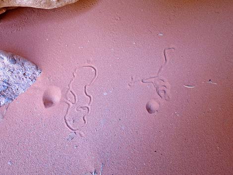 Don't overlook doodlebug tracks and ant traps |
Departing from 4WD Trailhead in Callville Wash (for details, see BOF SW 4WD Trailhead and Approach)
 4WD Trailhead in Callville Wash (view NW) |
 Callville Wash North Road trailhead (view N) |
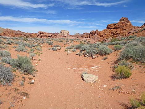
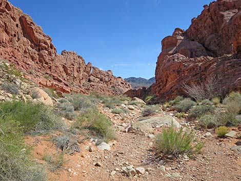
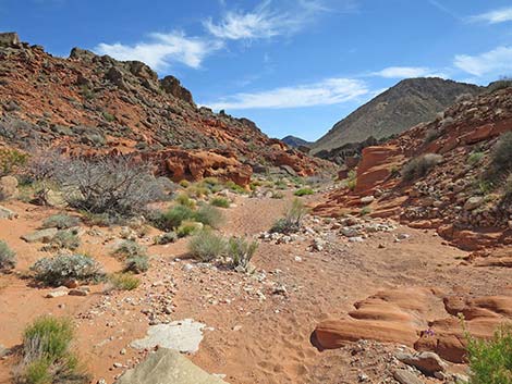
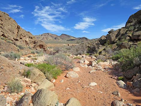
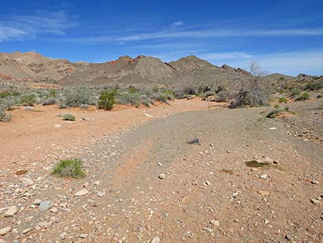 BOF SW Wash (view N) |
 Hikers passing outcrop of green mudstone (view N)E |
 Approaching gap in limestone ridge (view NW) |
 Hiker at Blue Pour-Over at entrance to BOF SW (view NW) |
Blue Pour-Over to Lunch Ledge
| Jumble of boulders at the Blue Pour-Over (view NW) |
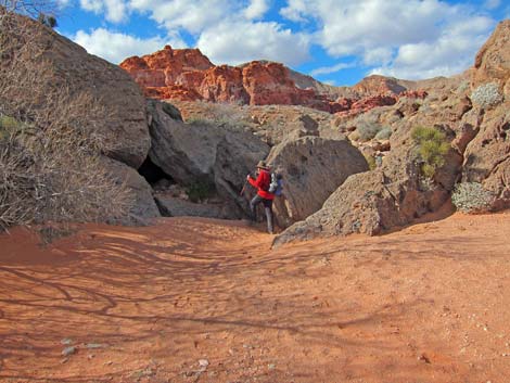
 An easy way to climb the Blue Pour-Over (view NW) |
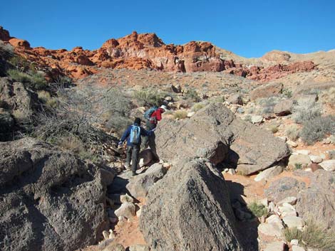 Hikers passing through jumble of conglomerate boulders |
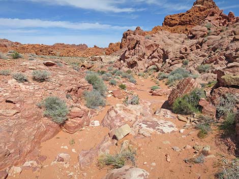
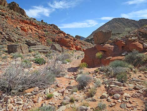
 The main wash continues (view N) |
 From the wash, the Loop route turns left (view NW) |
 Hikers can continue up the main wash to a side wash (view W) |
 Staying left, route runs up side-wash towards low bluff (view NW) |
 Route runs up side-wash towards low bluff (view NW) |
 Hikers starting up use-trail on first little hillside (view W) |
 Use-trail runs up first little hillside (view W) |
 Use-trail continues up the canyon (view W) |
 Use-trail crosses the wash (view W) |
 Hikers below red sandstone wall (view W) |
 Turning the corner below the red sandstone wall (view NW) |
 Route continues up the wash (view NW) |
 Approaching 15-ft pour-over, bypass cuts up hillside (view W) |
 Staying in wash, approaching the 15-ft pour-over (view W) |
 15-ft pour-over (view W) |
 Hikers passing the 15-ft pour-over (view W) |
 Looking back down from the top of the 15-ft pour-over (view E) |
 Above the 15-ft pour-over, the wash is jumbled with rocks (view W) |
 Above the 15-ft pour-over, the route stays on the hillside (view SW) |
 Use-trail continues beyond the Above the 15-ft pour-over (view W) |
 Route turns up hillside to pass through gap in the cliff (view S) |
 Approaching the gap (view S) |
 Gap in the cliffs (view S) |
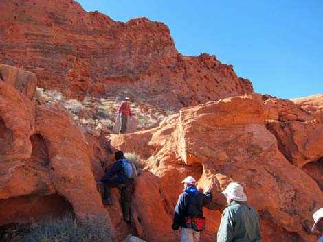 Hikers passing the gap in the cliffs (view SW) |
 Above the gap, the route turns onto sandstone slickrock (view NW) |
 Use-trail runs through valley between sandstone crags (view NW) |
 The route runs up under the shady crag below saddle (view NW) |
 Below the shady crag, the route heads up and left (view NW) |
 Hikers below the saddle (view NW) |
 Approaching the saddle (view NW) |
 Saddle (view NW) |
 Hiker crossing over the saddle (view NW) |
 Atop the saddle (view NW onto Lunch Ledge) |
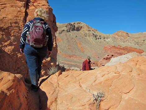
 Lunch Ledge (view W) |
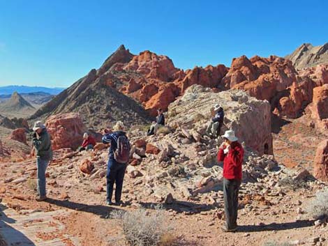 Hikers on Lunch Ledge (view SW) |
 Lunch Ledge (panorama view SW) |
 Lunch Ledge (panorama view W) |
 Lunch Ledge (panorama view NW) |
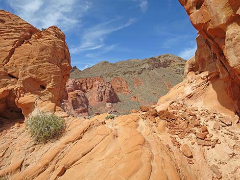
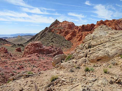
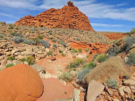
 Crags in the valley below Lunch Ledge (view W) |
Alternative Exit from Lunch Ledge to the North
 |
 |
 |
 |
 |
 |
 |
 |
Descent from Lunch Ledge to the South
 Departing Lunch Ledge to the south (view S) |
 Use-trail is, initially, easy to follow (view S) |
 Looking into the valley bottom (view W) |
 Route continues south towards "last" sandstone crag (view SW) |
 Turning the corner around the "last" sandstone crag (view SW) |
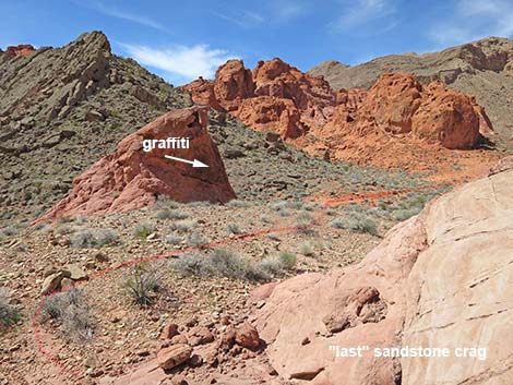 Route runs past a crag with graffiti |
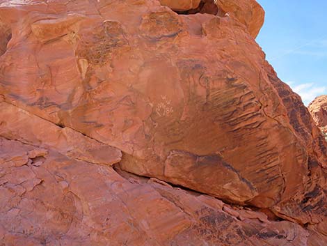 Crag with graffiti |
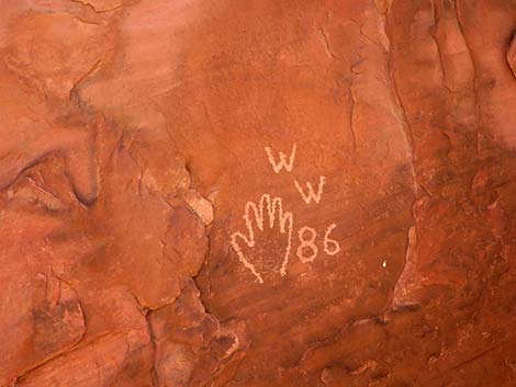 Graffiti: why must people do this? |
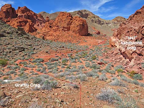 Route continues downhill between Graffiti Crag and Last Crag |
 Use-trail in the bottom of the valley (view N) |
 Hikers can use this trail to go south to Callville Wash Rd (view S) |
 Looking back up the route (view SE) |
 Use-trail fades into slickrock; route continues to saddle (view N) |
 Use-trail fades into slickrock (view N) |
 Saddle; highpoint behind BOF SW (view N) |
 Descending off slickrock, use-trail becomes apparent again (view N) |
 Use-trail continues across sandy valley bottom (view N) |
 Use-trail continues across sandy valley bottom (view N) |
 Use-trail drops into shallow wash (view NE) |
 Wash arrives at first little sandstone pour-over (view NE) |
 Route continues down the wash (view NE) |
 6-ft pour-over; bypass using ramp on right (view NE) |
 Confluence; wash merges from the left (view NE) |
 Alternate descent from Lunch Ledge merges here (view NE) |
 Route continues down the wash (view NE) |
 Route continues down the wash (view NE) |
 Hiker in the wash (view NE) |
 Route arriving at Three-Forks (view N) |
 At Three-Forks, route continues downhill (view NE) |
 Below Three-Forks, route continues into gorge (view E) |
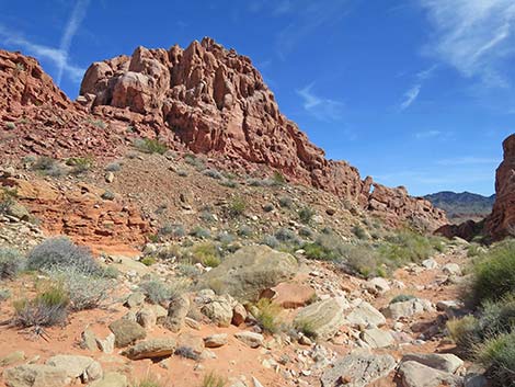
 Red sandstone cliffs tower above the gorge (view E) |
 Hiker entering shade in the gorge (view E) |
 In gorge, route continues towards Red Sandstone Wall (view E) |
 At Red Sandstone Wall, wash bends right (view SE) |
 Route continues down the wash (view SE) |
 Route continues down the wash; window become visible (view SE) |
 Major wash merges from the left (view SE) |
 Route continues below confluence (view SE) |
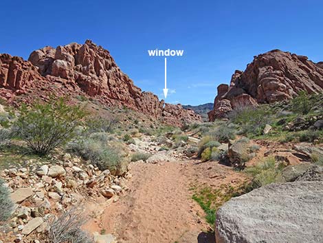
 Window above the "narrows" (view SE) |
 Window above the "narrows" disappears (view SE) |
 Another window in the left wall (view E) |
 Window in the left wall (view E) |
 The route exits the "narrows" (view SE) |
 Route continues down the wash (view SE) |
 The wash bends left (view E) |
 Route continues through jumble of boulders (view E) |
 Wash merges into major wash on the left (view SE) |
 Route continues down the wash (view S) |
 Approaching Balanced Rock, on the right (view SE) |
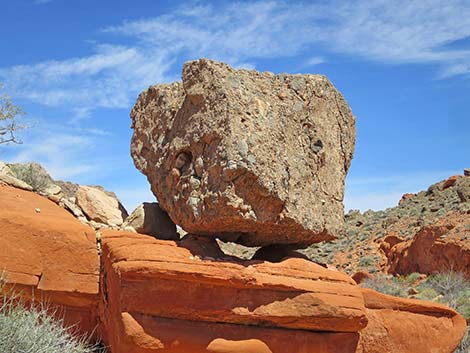 Looking back at Balanced Rock (view NW) |
 Route continues down the wash (view SE) |
 Route gap in the limestone ridge (view SE) |
 Approaching the Blue Pour-Over (view E) |
 Hikers passing the Blue Pour-Over (view E) |
 Atop Blue Pour-Over (view E) |
 Below Blue Pour-Over, route continues down the wash (view E) |
 Route continues down the wash (view SE) |
 The right bank walls up (view SE) |
 Returning over first of the blue mudstones in the wash (view SE) |
 Wash hits stone wall and bends right (view SE) |
 Just beyond stone wall, trail to Mile 18.2 TH departs wash (view SE) |
 Hikers exiting BOF SW Wash (view E) |
Exit Route to 4WD Trailhead in Callville Wash
 Route to Callville Wash 4WD Trailhead stays right in the wash (view S) |
 Route continues down wash past last blue mudstone (view S) |
 The wash begins to open up onto desert flats (view S) |
 Sandy wash approaching Callville Wash 4WD Trailhead (view SW) |
 Arriving at Callville Wash 4WD Trailhead (view SW) |
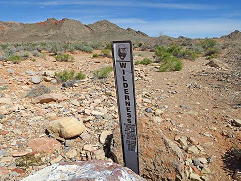 Looking back at trailhead Wilderness boundary sign (view N) |
Exit Route to Mile 18.2 Trailhead on Northshore Road
Just beyond stone wall, trail to Mile 18.2 TH departs wash (view SE) |
Hikers exiting BOF SW Wash (view E) |
 Hikers crossing desert flats towards Hill 651 (view SE) |
 Hikers crossing Callville Wash towards Hill 651 (view SE) |
 Hikers approaching north toe of Hill 651 (view E) |
 Hikers crossing desert flats towards Mile 18.2 Trailhead (view S) |
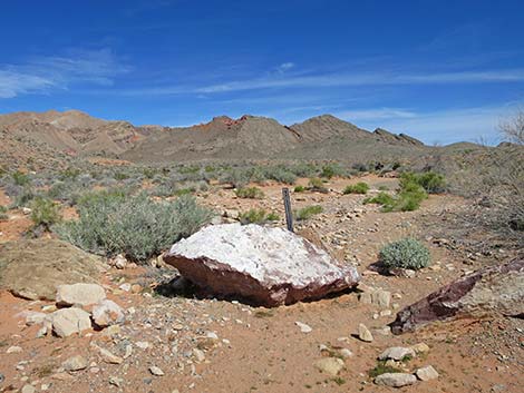
Table 1. Hiking Coordinates Based on GPS Data (NAD27; UTM Zone 11S). Download Hiking GPS Waypoints (*.gpx) file.
| Wpt. | Location | UTM Easting | UTM Northing | Elevation (ft) | Point-to-Point Distance (mi) | Cumulative Distance (mi) |
|---|---|---|---|---|---|---|
| 01 | Mile 18.2 Trailhead | 710752 | 4009690 | 1,909 | 0.00 | 0.00 |
| 02 | North Toe of Ridge | 710638 | 4010209 | 1,868 | 0.35 | 0.35 |
| 03 | Trail Drops into Wash | 709990 | 4010590 | 1,858 | 0.06 | 0.41 |
| 04 | Entrance to BOF-SW | 709711 | 4010843 | 1,905 | 0.13 | 0.54 |
| 05 | Above Pour-Over | 709347 | 4010831 | 2,017 | 0.29 | 0.83 |
| 06 | Saddle | 709097 | 4010863 | 2,184 | 0.20 | 1.03 |
| 07 | Lunch Ledge | 709064 | 4010862 | 2,184 | 0.01 | 1.04 |
| 08 | Trail Junction | 708969 | 4010743 | 2,066 | 0.15 | 1.19 |
| 09 | Saddle | 708926 | 4010874 | 2,096 | 0.09 | 1.28 |
| 10 | Pour-Over | 709013 | 4011124 | 2,016 | 0.21 | 1.49 |
| 11 | Wash Forks | 709028 | 4011173 | 2,007 | 0.04 | 1.53 |
| 12 | Wash Forks 3 Ways | 709269 | 4011379 | 2,021 | 0.23 | 1.76 |
| 13 | Wash Bends West | 709418 | 4011424 | 2,005 | 0.11 | 1.87 |
| 14 | Wash Forks | 709525 | 4011272 | 1,932 | 0.13 | 2.00 |
| 15 | Wash Forks | 709684 | 4011028 | 1,939 | 0.20 | 2.20 |
| 04 | Entrance to BOF-SW | 709711 | 4010843 | 1,905 | 0.14 | 2.34 |
| 03 | Trail Drops into Wash | 709990 | 4010590 | 1,858 | 0.26 | 2.60 |
| 02 | North Toe of Ridge | 710638 | 4010209 | 1,868 | 0.50 | 3.10 |
| 01 | Mile 18.2 Trailhead | 710752 | 4009690 | 1,909 | 0.35 | 3.45 |
| 01a | 4WD Trailhead | 710068 | 4010221 | 1,846 | . | . |
Happy Hiking! All distances, elevations, and other facts are approximate.
![]() ; Last updated 240515
; Last updated 240515
| Hiking Around Lake Mead | Hiking Around Las Vegas | Glossary | Copyright, Conditions, Disclaimer | Home |