 |
| Home | Birding | Favorites | Portal Area | Area Map |
Birding South Fork of Cave Creek Map
Birding Around Las Vegas, Favorite Places Far Away |
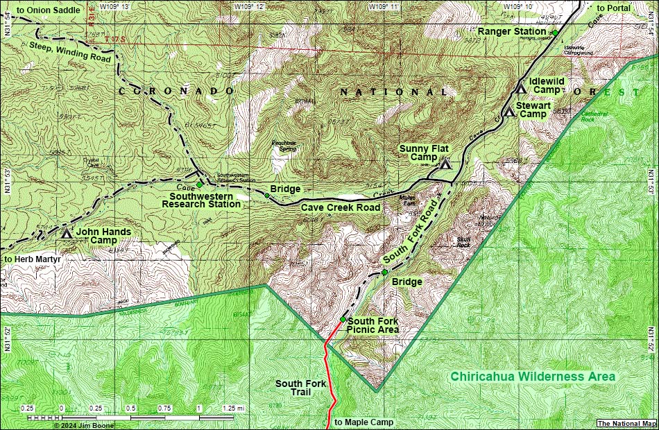 |
| Note: Map based on USGS 7.5-minute topo map, which may have red grid lines and various numbers. North is at the top. Grid is UTM NAD27 CONUS. Roads are black (solid = paved; dashed = unpaved; width implies quality). Trails and routes are red (solid = main; dashed = adjacent or alternate). Washes, streams, and lakes are blue (solid = permanent; dashed = intermittent). National Monument Areas (boundaries dash-dot green, fill light green) based on BLM data. Wilderness Areas (boundaries solid green, fill light green) based on BLM data. National Conservation Areas (boundaries dash-dot green, fill light green) based on BLM data. National Forest areas (boundaries dash-dot-dot brown, fill light green) based on USFS data. Download GPS data: GPX or KML. |
Note: All distances, elevations, and other facts are approximate.
 ; Last updated 240605 ; Last updated 240605 |
| tags: birdwatching, birds, portal, southeastern arizona, idlewild campground, stewart campground, sunny flat campground, south fork, maple camp, cave creek, southwestern research station, jonh hands, herb martyr, chiricahua wilderness area |
|